This discussion has been locked.
You can no longer post new replies to this discussion. If you have a question you can start a new discussion

Is my Edge getting confused when navigating a route?? See pics

I'm having a lot of problems navigating with my Garmin Edge 530, since I purchased the unit about 6 months ago.  I'm in Australia, and i have an Australian-delivered unit.  I had another terrible experience on the weekend and decided to try to figure out what was going wrong.

Here is a picture of the Edge 530 when I'm approaching a roundabout. The gpx route is to turn to the right. 

The roundabout icon on the top left of screen shows the exit in the correct direction, but it is suggesting i ride around the right side of the roundabout (wrong for Australia). 

The 3rd exit is correct for riding around the left side of the roundabout. And the name of the road to follow is correct.  So the top right of the screen works.

The arrow on the map says to turn left which is completely wrong.  I followed the arrow, and shortly after the unit told me i was off course. The map does not look anything like the OSM open street map on which the Garmin map is based.

(also not sure why i have 2 different distance markers, the lower one 98m is correct)


OSM shows the correct Australian navigation around the roundabout. - openstreetmap.org
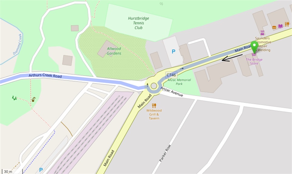
I'm about 100m from the roundabout.

Here is a second example.  The route per the gpx is the right hand turn.  See description with each picture below.  Can anyone explain what is happening with my unit?  I would be very grateful, thanks.

The OSM direction around the roundabout is correct for Australia
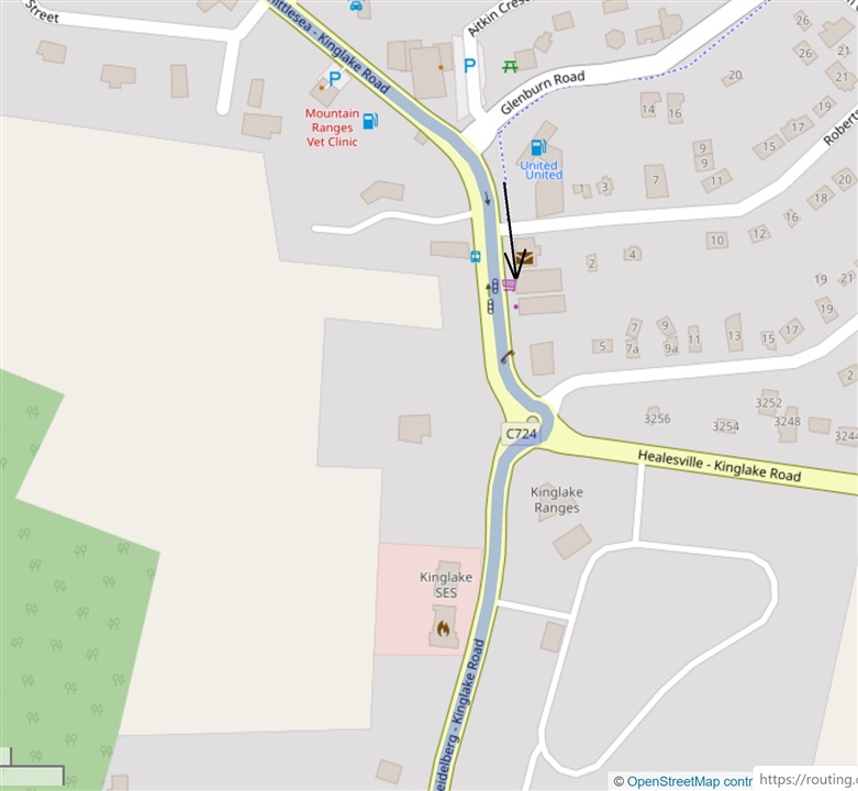
The roundabout icon at the top left of the Edge 530 is indicating the wrong direction this time.  It also says to go around the right hand side of the roundabout, also wrong. 

At the top right it says to take the 3rd exit, which is correct for going the correct way around the left side of the roundabout.  The street name to exit on is also correct out of the 4 uniquely named streets!  So the top right of the screen works again. 

The Edge 530 map again does not look like the OSM map.  You can see there are not any streets on the Edge 530 map approaching from the north, as indicated by the north pointer on the screen.  But as you can see from the OSM map the approach is almost directly from the north (page orientation).


The distance of 70m is wrong and 12m is correct.

So I am at a loss as to how to solve this. Based on these two examples I feel that

  • the top left roundabout icon has some form of American configuration,
  • the top right of the Nav screen works for Australia as intended,
  • the map shown is not related to the intersection being approached, and
  • the arrow direction on the map is getting confused by the mix of configurations. 

I've contacted the retailer, and I think I'll take the bike out again on a planned route to confirm these theories.

  • Nope. Still got the excessive zoom on my 830.

  • Thanks. I’m really curious to know how this issue manifests on the edge of 130, and the new edge 130+.  Do the turn by turn pop-ups tell you (for Australia/UK) to turn left into a roundabout, even if you want to take the third exit? And likewise (for America) does the edge 130 turn by turn pop-up tell you to turn right into a roundabout, even if you want to take the third exit? Thanks

  • If roundabouts are properly coded in the map you are told the number of the exit to take. The number will be correct for the side of the road you drive on. 

  • Sorry I was more meaning what direction is the main arrow on the pop-up going to be pointing 

  • If the roundabouts are properly coded in the map then you will be navigated around them correctly whatever side of the road you drive on.  The arrows will be point the correct way.

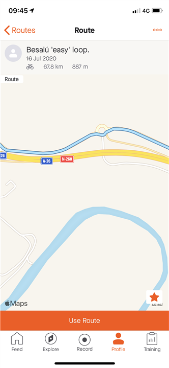
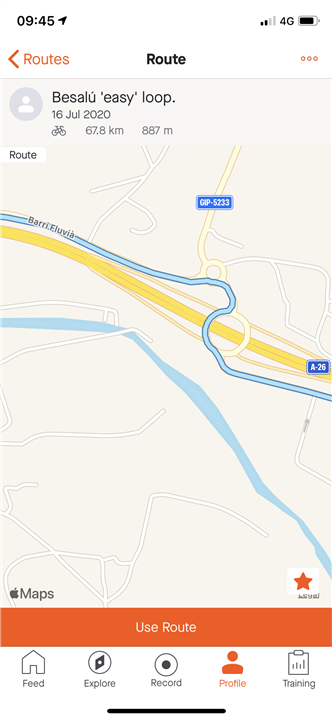
  • I am having a similar issue but I’ve traced it back to strava routes. I’m in Spain and plotted several rides and for roundabouts it seems me quite dangerously the wrong way round!!!

    During the rides I thought maybe there was a footpath the Marris we’re getting confused with but after passing a few roundabouts it was clear there was none. 

    Here’s a few examples taken from a strava route. 

    This is a recurring issue in several routes. 

  • It won't manifest in the 130 at all. Those units don't have maps at all and use a simpler "track following" navigation.

  • I've recently bought the 530 and am pretty disappointed with the TBT navigation. I was expecting it to be as good or better than my 1000. I know that was a top end unit but it is very old. I'm in the UK and as per others here (using strava synch and gps export from strava during garmin hack):

    1. It does some roundabouts but struggle on others

    2. It gets totally confused on "out and back" routes, telling me to do a U turn once started

    3. When you examine the map, the track of the route ridden is nowhere near the road graphic. Is this the cause of it's confusion ? If it doesn't know where it is very accurately, it's no surprise it struggles to navigate

    Also, can someone please advise me when i devaite from a course intentionally, then head towards the course again, should i hit the recalculate option or reject ?

    cheers

    MB

  • Is rejecting the 530 outright an option?

  • 1. This is fixed by using different maps from the Garmin supplied ones. They are freely available and you can even make your own. 

    2 may be related to 3. If your planned track is not near the road on the map then you need to use different maps when route planning. The Garmin maps (and third party maps for Garmin units) are based on OpenStreetMap. You need to make sure your route planner is using OpenStreetMap based maps for optimal results. Do not use Google map layers route planning.

    RideWithGPS has OpenStreetMap map options. Strava's route planner uses OpenStreetMap based maps. Garmin's route planner has an OpenStreetMap option.