This discussion has been locked.
You can no longer post new replies to this discussion. If you have a question you can start a new discussion

Is my Edge getting confused when navigating a route?? See pics

I'm having a lot of problems navigating with my Garmin Edge 530, since I purchased the unit about 6 months ago.  I'm in Australia, and i have an Australian-delivered unit.  I had another terrible experience on the weekend and decided to try to figure out what was going wrong.

Here is a picture of the Edge 530 when I'm approaching a roundabout. The gpx route is to turn to the right. 

The roundabout icon on the top left of screen shows the exit in the correct direction, but it is suggesting i ride around the right side of the roundabout (wrong for Australia). 

The 3rd exit is correct for riding around the left side of the roundabout. And the name of the road to follow is correct.  So the top right of the screen works.

The arrow on the map says to turn left which is completely wrong.  I followed the arrow, and shortly after the unit told me i was off course. The map does not look anything like the OSM open street map on which the Garmin map is based.

(also not sure why i have 2 different distance markers, the lower one 98m is correct)


OSM shows the correct Australian navigation around the roundabout. - openstreetmap.org
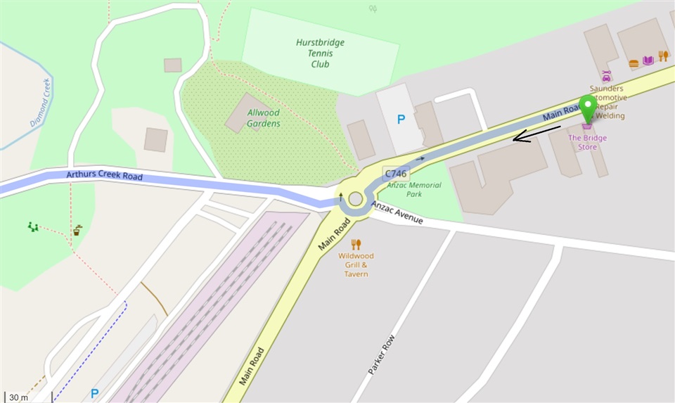
I'm about 100m from the roundabout.

Here is a second example.  The route per the gpx is the right hand turn.  See description with each picture below.  Can anyone explain what is happening with my unit?  I would be very grateful, thanks.

The OSM direction around the roundabout is correct for Australia
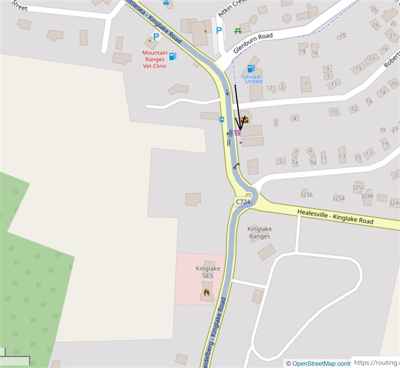
The roundabout icon at the top left of the Edge 530 is indicating the wrong direction this time.  It also says to go around the right hand side of the roundabout, also wrong. 

At the top right it says to take the 3rd exit, which is correct for going the correct way around the left side of the roundabout.  The street name to exit on is also correct out of the 4 uniquely named streets!  So the top right of the screen works again. 

The Edge 530 map again does not look like the OSM map.  You can see there are not any streets on the Edge 530 map approaching from the north, as indicated by the north pointer on the screen.  But as you can see from the OSM map the approach is almost directly from the north (page orientation).


The distance of 70m is wrong and 12m is correct.

So I am at a loss as to how to solve this. Based on these two examples I feel that

  • the top left roundabout icon has some form of American configuration,
  • the top right of the Nav screen works for Australia as intended,
  • the map shown is not related to the intersection being approached, and
  • the arrow direction on the map is getting confused by the mix of configurations. 

I've contacted the retailer, and I think I'll take the bike out again on a planned route to confirm these theories.

  • Thanks mate. I've mainly been using Strava route planning and certainly used that one for the out and back (time trail) route the other week. Although strava has overhauled is route maps when they re-launched the subscription service a couple of months ago. Do you know if they still use OSM ? I'm happy to switch to GC or RWGPS if needed.

    I assume (maybe wrongly?) that garmin has one current version of UK cycling maps and that, therefore, is the same my edge 1000 is using ? It's not like the 1000 is perfect, but it doesn't tend to struggle on roundabouts.

    I did wonder if accuracy was an issue so i swtiched to GPS + glonass (prev GPS + Galileo), but that hasn't helped.

    MB

  • Maybe you have older maps on your 1000 and they are OK? The current Garmin cycling maps (for western Europe at least that for around me in the UK and a quick test somewhere in the Netherlands) don't have roundabouts marked properly which is why they don't navigate as you would expect them to.  Third party maps tend to have them marked properly so they navigate properly.

    I think Strava's maps are still based on OSM.  I use RideWithGPS and have never had an issue with the plotted routes not lining up with the roads as long as you use one of the OSM based map layers when planning.  If you zoom in to far you may see the plotted route not line up properly with the road but that zoom level is too far in to be useful.  That is down to the resolution of the map data in the maps.

  • After all this time, did Garmin find a solution to fix this TBT limitation for roundabouts? I Live in UK and honestly I don't want to buy any 530 or 830 if this issue persist.

    I just want a device that I can quickly download a map from Strava and use it, no ifs or buts. Otherwise I'll keep with my Edge 810, which is not the best but at least I might accept the limitations of a 2013's device has.

  • Everything works just fine if you use third party maps.  Those are easily available so shouldn't stop you getting one.

  • the TBT does work as per your help and suggestions in this thread (thanks again), but i don't agree that everything works just fine. This super zoom issue discussed here and on other threads is still present. So the TBT instructions do work but when i'm riding along and take a quick glance my eyes tend to focus more on the map graphic, which is misleading when you get this. It's still a navigation bug and annoying, albeit not all the time. The method of scrolling down to the map screen when there are not any instructions and zooming out does help but doesn't eliminate it, in my experience.

    MB

  • Agree – in short, not resolved.

    take your money elsewhere :) 

  • Well, that's the challenge. The last DCR review of the latest colour screen wahoo, that i saw, also pointed out TBT shortcomings. I also find the wahoo units very bulky and ugly, but that's obviously personal. The Hammerhead karoo is very big (karoo 2 also) and feels the need to have functionality to work without a phone (who goes out without their phone?). I'm still happy with my 530, but partly because there's no better option for me.

    MB

  • @meltonboy yes the superzoom issue is still there as far as I know but the question from @mmcinza appeared to me to be more about directions at roundabouts which is not affected by the zoom issue, only the maps.

    In short with 3rd party maps you get proper direction text but whatever maps you use sometimes the units zoom in to far to make the pop up map display with the junction on too zoomed in to make what is happening.

    With this information users can decide whether it is a deal-breaker or something they can live with. Personally I am sticking with Garmin as I like making my own maps and can live with the zoom issue.