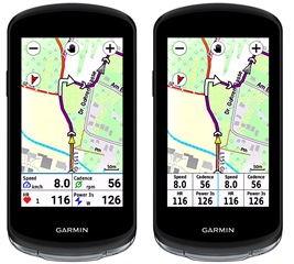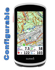
EDGE MapFields

IQ Store Link

New device: EDGE 1050 !

Edge Mapfields is meant for use with the mapscreen on your device.
There are 4 fields, which every field can set with many options (see below).
It's created for Edge 1030, 1040, 1050, 530 and 830, 540, 840 and Explore and Explore2

This datafield is free of charge, but if you like it and use it, it would be nice to be invited to a beer: paypal.me/AndreasWirth

After installing the datafield on your device, place a full-width field under the map. In this field you put the EdgeMapsFields.

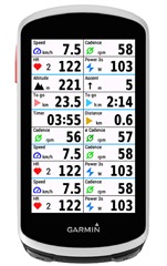
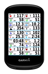
In the setup you can choose a display for each quadrant from many different options:
see:
https://apps.garmin.com/apps/30fdcbb5-a0f2-4832-9157-b7dcd81e7a0f

Both metric and statute format!

Time to Destination is calculated by your average speed. In the beginning - when no average speed is available - Time to Dest. is calculated by 10 km/h ( 6.214 mi/h).

Timer format is mm:ss for time less than one hour, and h:mm for time more than one hour.

Of course you can use this datafield on every screen with a datafield of 1/5 of the screen height.

Note: the pictures below are photoshoped to show all options on one picture.
You can only set one datafield on your device!


  • Thank you for your fast and thorough reply. The course was pre-planned using Garmin Connect. The elevation profile Garmin provides is quite poor and often suggests flatter stretches where none are found (RIP legs). My general speed for the climbs in question is around 10 km/h, so not exactly fast.

    I am wondering if the issue comes down to GPS accuracy?

    The poor performance was particularly on a road going from to Col du Coq from Brevardiere, which is kinda a narrow road between mountains and with dense tree cover. I attempted to take a photo of the computer at one point, but the field was grade/cadence and switched before could take catch it, but I did get a geotagged photo and going back to the fit file indicates the average gradient +/- 300 meters around the spot should be around 10.5%. At this point Garmin is claiming 2-3%, so not really sure what is going on.

    I had the GPS accuracy set to auto, but I will use the best accuracy and multi band next time. Hopefully I'll see better accuracy. 

  • I am wondering if the issue comes down to GPS accuracy?

    Yes, that is the solution to the puzzle!

    A serious grade calculation needs a precise distance (=speed) measurment.
    You should use a speedsensor (it‘s not that expensive).