This discussion has been locked.
You can no longer post new replies to this discussion. If you have a question you can start a new discussion

Problem with Altitude data. Barometric sensor issues

This is to show the real issue with barometric sensor within the Garmin Edge 1030 plus.

Has been discussed in several threads, also linked to the Gradient data issue. This topic is related to Elevation data itself.

This photos were taked in a ride before the climb to a mountain and at the top.

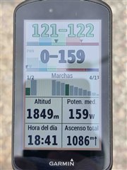
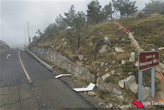
1. Photo doing calibration altitude at 1200m, both the Road Signal (altitud = altitude in english) and the Edge.
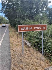
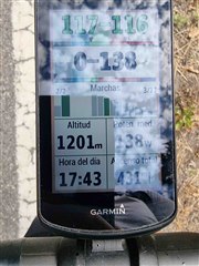
2. Photos taken at the top of the climb:

Yo can see that even calibrating it at 1.200m (I do not know why I set 1.200m and a second later shows 1.201m, but 1 meter is fine for me), at the top, 1 hour later there is a difference is 51m which is huge (Garmin 1.849m, real 1.880m). I do not have the Garmin Edge 1030 yet, but I can ensure you is much more precise, within a range of 1-2 meters, and has been spot on on this matter for 2,5 years with me.

Please Garmin, Solve whatever issue this model have with Altitude.

Top Replies

All Replies

  • A few thoughts on this:
    In general, I have found no problem with both Edge 1030 and PLUS that the absolute altitude display is not correct.
    I am not satisfied with the response time of the display to altitude changes - and that's what many threads are about.

    About your pictures:
    They can of course be evidence that your device is not working properly. But it may also be that 1) the roadside signs are not accurate and/or 2) that the absolute air pressure changed a lot during the climb.

    Of course, if you find this error every time you go uphill, then there is probably something wrong with your device.

  • Hi Mcinner1, nice to speak with you again.

    About your points,

    1) I'm pretty sure these road signs are accurate, it's a very known port here in Madrid (part of the Vuelta de España by the way) ;-). It's not a lost port anywhere climb in Spain.

    2) It could be, but in a hour it's too much variation. The barometric pressure does not change quickly unless there is a strom comming or going out, which is not te case yesterday.

    I agree with you that sometimes happens point 2, I see it several times with the Edge 1030, but when it is not the case (most of the time), the Edge 1030 has been dead spot on, which is not the case with Edge 1030 plus.

    I'm thinking that if nobody has this issue with this model it could be mine could be a faulty unit...

  • Next week I‘m mtbiking in the Austrian Alps.
    I will have a look on it!

  • Enjoy them all then and come back to us if possible !

    Happy holidays!

  • The exact altitude next to that "town sign" is apprx 1854m, the 1880m is referred to the highest point of the town, and not where You took the photo... so there is no problem. But a barometer can drift up or down due to special weather conditions, it is not a reference altitude meter, for that, You need survey-grade GPS receiver with RTK service....

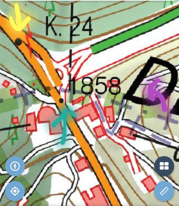
    A small visual help:

    • You took the photo at yellow arrow apprx (big black dot, 24km stone/sign), the highest altitude on road is 1858m with green arrow (and small black dot), the 1880m is at the purple arrow, probably the ski resort or that single old building next to the parking lot is the highest point of the "town". (I dont know what was the criteria by spanish geographic department)

  •  , you are right.

    See picture below:
    The altitude of the road in this area is 1.858 m !

  •  yes, "usually" i´m right! Joy

    i didnt check it on Earth Pro yesterday (i checked on the official spanish topo map on my mobile) but now i did and it says 1856m exactly next to the sign. The Google elevation says 1859m for the highest road altitude there, unfortunately i'm living a "little" bit far away to go there and do a surveying and telling the absolute accurate and precise elevation data (that is it 1858m or 1859m) Relaxed

  • According to the maps you are right!. That is very odd, as this is a well known port climb here in Madrid, as as I said before to Mcinner1 is part of the Vuelta de España.

    I will look a little bit more to understand this extrange behaviour in the signal. Usually at the known ports here in Spain there is a signal with the altitude of the port. Never heard this is the most elevated point of the town as in some ports there is no town like here.

    Regards and thanks! Everyday learning things ;-)

  • Today I did a second controlled test.

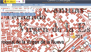
    At the start of the ride, I calibrate the altitude data at the point marked with yellow arrow. I did the ride and at the end I come back to the exact same point. The Edge reading  at the end was 692, so at the end 9 meters difference at same point.

    Route:https://connect.garmin.com/modern/activity/7206161677

    I will do the same with the Garmin 935 and Edge 1030 plus to see the results and share here!!

  • I think this topomap data is not accurate, the accurate altitude data is at that point is 694-695m (not 701m for sure, maybe it is a very old survey data with inaccurate devices), i dont have time to find a fresh LiDAR based topo data for that exact place but if i will have time, i will search..

    i think You spend too much time with this unnecessary :) 

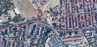
    meanwhile i found a more accurate datapoint near to this ( i think You know this place good from a sat pic), here, it is 725m (or 726m on an older map) from a Lidar based source, try to calibrate to this point and test with it if You have so many free time :)