Course creation

How do you all create courses to follow within a profile?

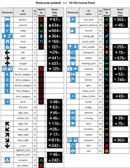
I do a lot of trail running in mountain areas. I find the course creation rubbish with Garmin Connect so I use Plotaroute. I then add waypoints for the summits and anything else like a water source.
I then save this as a .fit file and upload that to the NEWFILES folder within the GARMIN folder using a PC.
I can then select my trail run profile and the course I created. I can see the distance to the next waypoint etc.

With the purchase of a new F7X Sapphire I thought these waypoints would also be listed in the Up Ahead screen but they're not. Just the start and finish.

Just wondering what everybody else uses to do the same thing?

Also any way of doing this directly from a iPhone or iPad and sending directly to a watch, even using software that's linked to Garmin?

  • I was also wondering about that, but then I decided I prefer to have a dedicated custom screen with fields about the next waypoint, including waypoint name. this way you can have the map screen in fullscreen, removing that one data field.

    would be still cool to have the icon on the custom screen as field 1 or something, what a luxury would that be!

  • Hi, when I export a gpx file from locus map, the waypoints are displayed in the Garmin connect app. But when I export a fit file, then the waypoints are never displayed. Is that normal?

    Which is the difference about navigating a gpx or fit file?

    Thanks for your help

  • Dont want to hijack this post, just want to ask the round to check and vote if following bug already affects you in respect to broken fit course download in offline mode (only Bluetooth on). I guess not many people are aware of this problem and garmin is not focusing on this. But was a killer feature for most of us:

    forums.garmin.com/.../need-to-turn-on-mobile-connection-to-download-fit-file-over-bluetooth

  • Hello

    I'm new to Garmin and fiddling around with Trail Running Navigation. Found Plotaroute FIT export and transfer via USB works best. As I'm long year Locus user (the one who requested strict navigation, fix on route, TBT announcement configuration...), I would like to use Locus for route creation and tried it out. For that I used gimporter/exporter to bring the Fit file from the phone to the Fenix 7 Pro. Since this, I got the problem showed in page 12 from Matthias in this thread with the turn instructions shown on the screen. Even at routes I created with Plotaroute before my Locus experiment. And this is annoying. Does Locus import and/or Gimporter configures something different on the device? I would like to get rid of these again.

    Thanks

  • Do you mean the course point/turn direction description you have written (or is automatically created) in Plotaroute or Locus?

    I now found a way to hide the course point description on the map via the MapTheme file. It is the style field MPM_HGLT_TXT_CLR that controls the text on the map for course points. This text hides the text:

    <style field="MPM_HGLT_TXT_CLR"><color>
    <primary day="#00ffffff" night="#00ffffff"/>
    <secondary day="#00ffffff" night="#00ffffff"/></color></style>

    Primary is foreground and secondary is background color.

    Try this if you're not familiar with changing theme files: OrangeOrange13.kmtf

    More info about map themes here: https://forums.garmin.com/outdoor-recreation/outdoor-recreation/f/fenix-6-series/204247/how-to-change-the-colour-of-navigation-course-follow-line-with-your-own-map-theme

    Copy the file to /GARMIN/MAPTHEMES folder on your device and then select that theme in your activity.

    (This file also changes the color of the course follow line, virtual partner arrow, your position arrow, and the arrows that show what course line to follow.)

  • I wonder if there is a good description of all tags used in the map theme file? I experimented with editing a custom map theme myself trying to improve contrast of the map. However I can't get rid of the light green background on the map that appears in some places but not in others. I was able to change some of that to white but not everywhere.

  • I did a lot of searches for 4 years ago but didn't find any.

    I've done my own TYP-file and build my IMG-file myself to get a map that is readable for a 50+ man...

  • Hi, trying to plan routes with the locus map app, then send it to my garmin fenix 7. After many testing I found the better way to do it. I was trying to export as gpx, then import into connect, then export to the watch. This kind of works, but the waypoint alerts are not properly appearing.

    Now I create the route with Locus app for android, then export it directly into the watch via bluetooth, with different apps from the connect IQ (gimporter or locus map).

    There is only a small issue. If I export it with gpx format the waypoint alerts are not happening, and the up ahead feature is complete useless. I reported this long time ago, looks like is not possible to solve.

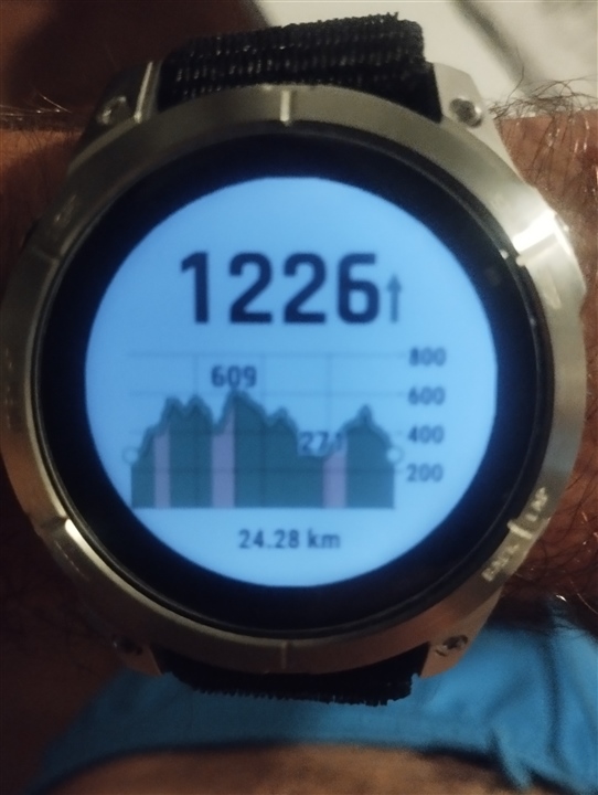
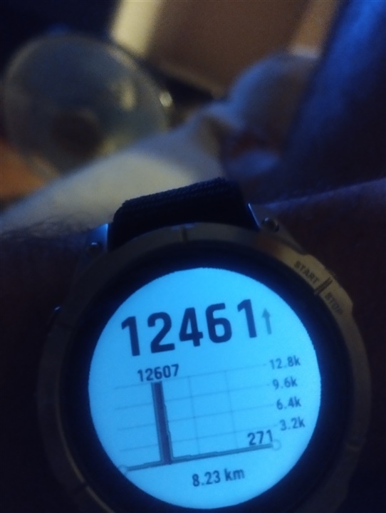
    Now, if I export it directly in .fit format the waypoints are displayed correctly, but, the elevation graph is completely destroyed.

    Route exported as .fit:

    Same Route exported as .gpx:

    Of course, the correct elevation is the gpx one.  Climb pro working properly in the fit file, except the last climb where is located the problem.

    Anyone can help me with that?

    Thanks in advance.

  • Fit file is the way to go. The last GPS points must have the wrong elevation data in it before transferring. 

    Look at the elevation profile in the tool you used (locus or plotaroute.com) and see if you can find the error.

  • First thing I thought, thanks. But when I export the same route to gpx there is no problem with the elevation profile. The route itself has no problem with the elevation graph. So the problem appears when exporting to fit, or when introducing the fit file into the watch. It's kinda strange...

    I attach another photo with the problem at the middle of the route