fenix 6x navigation details respective to waypoints and route elevation

I have garmin 6x. In naviation I have some information like ETA or distance to next. But IIUC these relates to change in direction. So when I'm hiking some trail, the watch beeps constantly because of frequent turns, and having ETA on next turn, which is 50m away, is not that useful. 

question 1: In GarminConnect, I can create user waypoints and NAME them. Is it somehow possible to get distance/time to those waypoints? Because I can easily guess, in what time I'll be at that turn I literaly can see, but knowing the estimate to peek based on current pace would be really helpful.

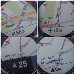
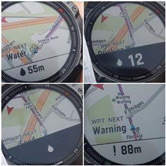
question 2: when I arrive to such custom waypoint, its name isn't shown. At best I get some number on screen. What's that? How can I work with that? Is it possible to display name? Or how can I interpret the number?

question 3: ETE/ETA are based on what? Is it average speed of the overal trip or what? It seems, that elevation profile isn't taken into account at all. Example: route is uploaded into watch and started. Route started, and I'm climbing 1500m elevation to the peek. The speed is say 2-3km/h. Then the route down is bumpy or my knees sucks, so even if I'm descending, I'm doing again 2-3km/h. Now after descend is done and there is just some final flatland at the end of trip and watch can see, that there is no ascend/descend ahead of me, and I'm happily walking 7km/h for last 10 minutes. I think it's possible to make better guess, than that the last 4 kilometers would require 2 hours to make. Is there some option to turn elevation evaluation into account, or do not predict future on overal average speed? Or anything which can improve estimations?

  • I use plotaroute routes every week and don't see the strange things you see.

    Tip for course points/tbt editing in plotaroute (or directions that plotaroute calls them)

    • Put your description in Notes field
    • No label text
    • Double check that no direction arrow is selected when you want other symbols
    • Only specific symbols are supported by fit file standard and then exported to fit by plotaroute. See below.

    Regarding symbols, see this plotaroute forum post: https://www.plotaroute.com/mobile/posts/1368/D/1

    From forum.

    We've also added support for the following course point types in both TCX and FIT files:

    • Summit (plotaroute Mountain symbol)
    • Water (plotaroute Drinking Water symbol)
    • Food (plotaroute Food symbol)
    • Danger (plotaroute Warning symbol)
    • First Aid (plotaroute First Aid or Ambulance symbols)
    • Sprint ((plotaroute Runners symbol)

    Great compilation from above link posted by Marcos Saad

    Type Garmin Plotaroute Symbol/Arrow
    generic 0 none none
    summit 1 Mountain none
    valley 2    
    water 3 Drinking Water none
    food 4 Food none
    danger 5 Warning none
    left 6 none Left
    right 7 none Right
    straight 8 None Straight on
    first_aid 9 first_aid none
    fourth_category 10    
    third_category 11    
    second_category 12    
    first_category 13    
    hors_category 14    
    sprint 15 Runners none
    left_fork 16    
    right_fork 17    
    middle_fork 18    
    slight_left 19 none Bear left
    sharp_left 20 none sharp_left
    slight_right 21 none Bear right
    sharp_right 22 none Sharp right
    u_turn 23 none Turn back
    segment_start 24    
    segment_end 25
  • @phoglund  I tried to create route exactly as you described: using plotaroute, not turn directions, custom points as you described. Route is public, link: https://www.plotaroute.com/route/1291084?units=km  Fit was uploaded by cable to watch

    This route was testing all symbols. SOME of them was appearing, always in order <SYMBOL> <NUMBER>, followed by extra <SYMBOL> notification. Example "warning" point was shown as "! 407", followed later by "!" notification. Summit/mountain was displayed as flag, which is general point IIUC. Water, firstaid and food wasn't displayed at all.

    Each point has text, no text was displayed. Not sure WHERE it should be displayed. I had opened map and then some data fields, and notification was always in lower part of screen, it tht stripe. Maybe the text would be visible elsewhere. If that's the case, please suggest. I saw some screensshot I cannot get on my watch, namely "guide" looks on my watch just as a superbly big arrow with some pointless information. Maybe there is setting for that?

    No turn warnings were issued, which is great improvement.

    Regarding missed points — I missed some points in short testing before, but for example "food" was working last time. It might be related to GPS and speed. I was driving car ~150km/h, and map was lagging as hell. Both with gps+glonass and with gps only. I wasn't able to convince map to zoom out from 50m closeup. Activity used was other and then either hike or bike, not sure now.

    I will retest it again on-foot, but if you have any comments on any of that, I'd be grateful.

    EDIT: yes and my device is garmin 6x

    M.

  • Looks correct. Latest weeks I've only been using direction.

    Around a month ago I ran a lot with two courses in parallel. Same route, but one created with only directions and one only with other waypoints. Switching between them during run with a hotkey for the navigation menu.

    Symbols and ete for them worked fine.

    I'll test again with newer watchOS and newer fit exporter on plotaroute.

    Hmmm, do you have activity settings-> Routing-> Activity-> Direct routing? Try Running & walking.

  • No prob while walking from the bus.

     9

  • Thanks!

    quesitons:

    a) I see that there is no text from description/notes field. This is not displayed or you didn't enter it?

    b) I retest just now walking, with walk setting, running&walking routing, follow course, gps+glonass, no proximity alerts. I got first notification soon after start (the first point was close), then it missed 2, and last two I got correctly AFTER I was notified, that I'm back on track. Today in car I was getting notification "back on track" every 10s. SO I'd conclude from that, that my watch looses track.And when it thinks I'm not on track, it does not display information about close points ON track.

    c) how to setup on-track/off-track notifications? I can turn off the off track (which is what I did, therefore I didn't get the notification and have to retest once again), but on-track keeps popping on and on.

    d) how to setup on-track/off-track sensitivity? Last time in woods I was getting *** readings for several kilometers, because I was according to watch very very close to route, yet while I was getting closer and closer to the end along the route, the distance wasn't getting smaller, it was sometimes even getting bigger! Then suddenly beep! on track! And 2km was removed like this from remaining distance. This is not very convenient. Is it configurable somehow? Position WAS OK, as I can confirm from position rendered on map, but watch thought I off route.

    e) please how do you check updates? I thought they are automated. Where can I find current version?

  • My route: www.plotaroute.com/.../1291800

    I see that there is no text from description/notes field.

    Water, warning, food, Help are all my texts in the Notes field.

    One strange thing I see now is in the last two screens, with the mountain symbol. I have 'Top' as text. In the second last you can see that Top is displayed behind the popup, in the last screen that text is changed to the symbol name 'Mountain'. I also see that at the top. It says 'Water' first, on the second screen, I see symbol type 'Drinking water' in behind when close to the waypoint.

    On the map itself, you can see both symbol type name and my text in very small writing: 'Drinking water'-'Water', Food-Food, 'First aid'-'Help'. Can't remember that I've seen that before. Maybe new in this beta or in the latest watch versions. Maybe that introduced the bug above.

    it does not display information about close points ON track.

    Yes, that is as it always been (5x->6x).

    but on-track keeps popping on and on.

    I don't think you can change that. I want/like the off and on course messages. Wish it could be more beeps though.

    Is it configurable somehow?

    No. I never have any problem with it. If any, I think it could take too long before it gives me on-course when I'm on track again.

    please how do you check updates?

    Do you mean plotaroute updates? Actually, I didn't know that there have been updates to the site regarding fit export. Meant that it could have been things changed that could have broken the symbol export in fit. Sorry, just shortened the writing on the mobile... The watch has been updated several times for sure. Since yesterday I run the new beta.

  • AD updates: I was talking about watch updates. I rebooted to windows, go to garmin express, and there was missed update to 11.10.  I have NO idea how do you update to some beta version. I retest it again, ano there are no "wpt next" written on Map, neither is my custom text. I see it on your screenshot now, I overlooked it, because I thought nothing can be written there just as it is on my 6x. So how do you update your watch to newest version? Also garmin express or different?

    Regarding the writing of wtp names on map — that is configurable somehow? Maybe I turned it off somewhere without knowing the consequence. I'll try to restore "walk" to defaults, but I"m not aware of turning anything like that off. I just noticed, that you even see where the waypoint IS on map! Not only you have "wpt netxt water", but you actually see "water water" where the water is. I see nothing like that, just blank map. Can that be because of map selection? What map do you use?

    Regarding the on-course/off course — sometimes I get 'on-track' notification every 10s (when I was driving 150km/h) sometimes it takes minutes to get back to track even if I'm literary on it and watch themselves says that I'm not distant from track at all, and because of that I probably don't get any notification about waypoints. Any idea what it sometimes takes so, so long, and sometimes it keeps beeping?

  • missed update to 11.10

    The 11.10 is ok. I don't think there is no problem with symbols. I ran a lot of courses with directions with that version.

    there are no "wpt next" written on Map

    That is actually the standard data field 'Next waypoint' that I have configured to show up on map screen.

    Go to Activity settings-> Data screens-> goto Map screen-> Edit it to show one data field 'Next waypoint. (You can have max 2 data fields on map.)

    even see where the waypoint IS on map!

    I've seen that all the time, but it is a really small size and I can't see it while running anyway. The thing for me that is new is that it shows the waypoint type above the name. That's why it is 2 labels, water water.

    This was the standard Garmin map.

    I get 'on-track' notification every 10s (when I was driving 150km/h)

    I must admit that I never used my watch during driving. Map is lagging (around 15 m) when running, so I can understand if it is problematic while driving.

    Regarding lagging. Use the plotaroute feature 'Shift back' directions when downloading fit to get them at the correct spot. I always use shift back 15 m for running.

    Any idea what it sometimes takes so, so long, and sometimes it keeps beeping?

    Strange, no idea.