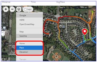
I have just noticed that Garmin has added new map overlays to the GPS track based on other metrics, such as HR, pace/speed or elevation.
This was a nice feature that I missed after changed to Garmin from Suunto.
I have just noticed that Garmin has added new map overlays to the GPS track based on other metrics, such as HR, pace/speed or elevation.
This was a nice feature that I missed after changed to Garmin from Suunto.