Satellite map & accuracy page in gps based activities

hey guys - what do you think - would it be useful if garmin would supply us with a data page that would show us the visible satellites, quality of the signal and accuracy information in gps based activities? there was this information on the 910xt - i think it's too bad they've removed it.

having this information could determine whether to use galileo or glonass straight from the watch - just an example...

  • Find an app named "GNSS View".  Excellent app, shows all sats, GNSS, Galileo, Glonass, Baidou, at any time of day or night.  Also has an AR display where you can hold your phone up to the sky and it will show where the birds are.  Free program too!

  • well - that's phone based app :-) - a thing i would avoid, if possible - as i tend to run with only just a few pieces of equipment; having that info on the watch itself would definitely spare carrying and checking the phone

  • What would be really cool, is if the watch could have an "auto-detect" setting that would automatically take samples from GPS, Glonass, and Galileo, and then pick the best combination automatically. It would probably take longer to get a GPS lock while it performs the test, but it would be worth it to remove all doubt about what the best setting is.

    I agree that the GPS signal strength meter on activity pages needs some work. It basically shows "4 bars" all the time, unless the signal disappears completely. But What does "4 bars" really mean? How many satellites does it see? What's the accuracy radius? As a data geek, I miss not having that information... just telling me "4 bars" isn't enough information. And I know the info is available, they just need to make a datafield that shows it.

  • Former Member
    0 Former Member over 5 years ago in reply to C.sco

    Yes i totally agree...

  • Number of satellites is one thing, but the accuracy depends also a lot of how far that are from each other. A DOP indicator or maybe precision radius could be nice indeed. But what about multipath ? Would the precision radius be still good because there are multiple visible satellites ? It must not be easy to give a reliable indicator. 

    Can't wait for the first dual frequency devices. It should solve or improve many problems. But satellites are not yet all using it, and just a few smartphones are using it, without tremendous results so far... We probably have to wait a couple of years before seeing good results. 

  • I’m so disappointed this information is removed! One of the real benefits of this is to see if the bars are “hollow” or not. If many are hollow, you shouldn’t enter a forest or similar. In that case, the watch won’t find the exact location of the satellites, and the accuracy of the position is reduced. CryWorried

  • I wish Garmin would implement it in someday but, I've been wishing it since Garmin Fenix 3... Sweat smile

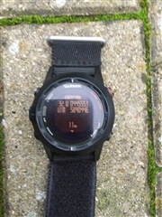
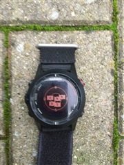
  • This was available on Fenix/2, but for successor devices they have removed it years ago.


    (sorry, pics from a (bad) quick sat fix, it is to cold to stay outside to get a better fix).

  • Again, another very useful feature that has been removed for no apparent reason. Please add it back Garmin!

  • I really miss it, after having this available on my old Forerunner 910. I wonder if one reason may be the GLONASS option coming in addition to GPS? We won't get the same picture as before. Still, it is so important to know if the orbit data is ready or not for each sattelite.If entering a dense area with only 4 to 6 fixes having orbit data, we are guaranteed getting a very bad track.