App & widget: Navmin

Former Member
Former Member
So that's time to show you my first ConnectIQ application:)


What it is?

Most of us, always have mobile phone on our trips, trenings and so on. Why to not use it, as tool for easily create navigation routes for our Garmin Edges? That was my idea. At begin application was created only for myself, but lot of my friends tell me that's it's great idea, so I decide made it easier to use (on Android side) and publish it.

How it's works?

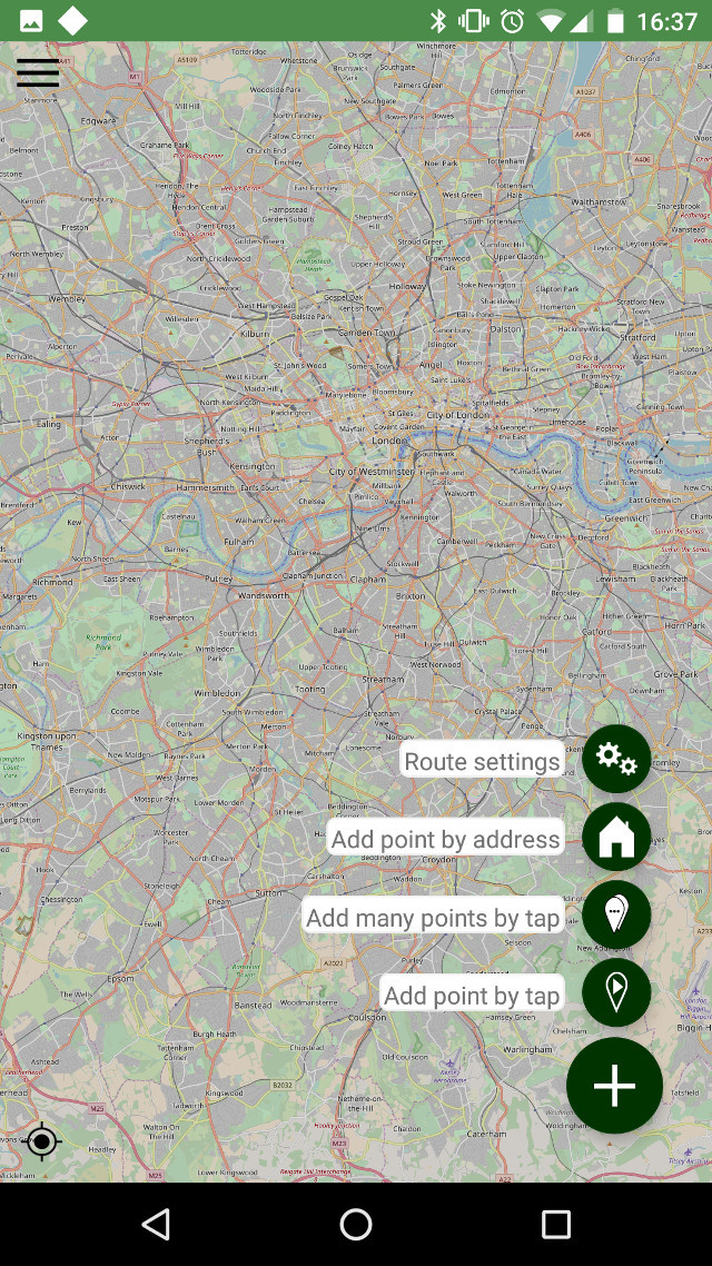
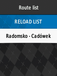
You need two parts - Android app on your mobile, and ConnectIQ application/widget on your Garmin. Then you can use it in few ways:
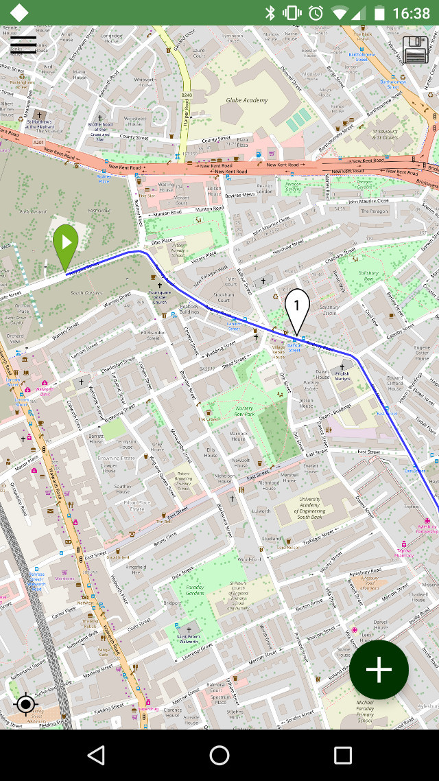
  • generate from point A to point B - points can be selected by "click" on the map, or by providing addresses
  • generate from point A to point B but via intermediate points,
  • "there and back again" - you give points and in the route generation options you select the "there and back again" option
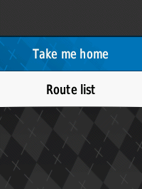
  • and... enter your "home address" in the android's application settings, and then from the application installed on your Garmin you will be able to quickly generate route to home. To be honest it's my favorit option - I can ride where I only want, and when I decide that is tiem go back, I even not need to take phone form my pocket - I just select this option in Navmin's widget, and my Edge 520 will tell me how I can back home:D

What more?

You can import TCX files from your mobile to Android's app, and then use them in your Garmin.

So why it cost?

One of most important reason is that the application to generate routes must use routing API. I'm decided to use great but commercial API, and I have to pay subscription fee for use it. Additional to not allow theft my key to this routing API, I decide to setup some kind of proxy backend between app and api. Proxy works on AWS - first year for free, but in nto so long future... And at the end - I live from programming. Just I hope, subscription's costs are not too expensive.

Future?

In near future - translations to German and Spanish. Then... be patient. I have soem I think great idea:D

URLs?

community.garmin.com/.../1307326.jpg community.garmin.com/.../1307327.jpg community.garmin.com/.../1307328.png community.garmin.com/.../1307329.png community.garmin.com/.../1307330.png
  • Former Member
    Former Member over 7 years ago
    As from some reasons (?) I'm unnable to edit my own post, so I have to add new one - movie with short how to for Android application.


    https://youtu.be/-breP56Hbkk
  • Former Member
    Former Member over 7 years ago
    Extended supported hardware to:
    - Garmin Edge® 1000
    - Garmin Edge® 1030
    - Garmin Edge® 520
    - Garmin Edge® 820
    - Garmin Edge® Explore 1000
    - Garmin Edge® Explore 820
    - Garmin Approach® S60
    - Garmin D2Tm Charlie
    - Garmin ForeAthlete® 735XTJ
    - Garmin Forerunner® 735XT
    - Garmin Forerunner® 935
    - Garmin Oregon® 7 Series
    - Garmin Rino® 7 Series
    - Garmin f?nix® 5
    - Garmin f?nix® 5S
    - Garmin f?nix® 5X
    - Garmin f?nix® Chronos
    :) I'm not have all of this to test layouts, so slowly I'll improve layouts in near future if it will be needed.
  • Former Member
    Former Member over 7 years ago
    And there is a new version of android app. And what's new:
    - increased number of intermediate points - 20 normally, 19 when with the return option, 10 when with the option to return through all points
    - added support for Imperial units
    - added possibility of not placing the distance between the navigation points in the FIT,
    - added option to disable limitation number of course points
    - added possibility of defining the maximum number of limit of course points,
    - corrected altitude graph error.

    For now it's in beta tests for few days - https://play.google.com/apps/testing/forcreation.pl.navmin
  • Former Member
    Former Member over 7 years ago
    Version 1.1.0 of Garmin Application/Widget and 1.2.0 of Android application. And this time:
    * in Android - should be available to install in next 1-2h:
    - NEW FEATURE - export routes (created or imported from TCX) as Garmin Segment,
    - NEW FEATURE - save state of map on main screen,
    - NEW FEATURE - possibility to edit saved routes - only created in Navmin, and only created from this version,
    - NEW FEATURE - possibility to downolad FIT file from routes list,
    - BUG FIX - better handle of settings.
    * in Garmin:
    - added support for downloading segments for Android application,
    - improved info/error messages.
  • Former Member
    Former Member over 7 years ago
    Small update - version 1.2.1 for android not require subscription for segments.
  • Former Member
    Former Member over 7 years ago
    In beta version of Android's APP (you can youn to beta tests here https://play.google.com/apps/testing...tion.pl.navmin) added possibility to import GPX's files (that's also mean, you can convert now TCX and GPX to segments). Tomorrow I should add possibility to download segments as a fit file, directly to phone. After few tests this version (1.3.0) should be released as stable:)
  • Former Member
    Former Member over 7 years ago
    New version 1.3.0 was just released.

    New, big update:

    - NEW FEATURE - import GPX files,
    - NEW FETAURE - importing GPX from Osmand, with turn by turn informations,
    - NEW FEATURE - save segments as a FIT file on your mobile,
    - NEW FEATURE - possibility to embed segments in new routes,
    - NEW FEATURE - altitude chart on route details page,
    - NEW FEATURE - preview on map on route details page,
    - NEW FEATURE - the ability to edit imported routes,
    - IMPROVEMENT - easier way to select place to insert new point on map.

    More details:
    Import GPX files
    Now Navmin allow you to import GPX files, including GPX from Osmand application, with turn by turn directions.

    Save segments as a FIT file on your mobile
    From now, you can save your routes as FIT files on your mobile, and then share(send) them with your friend, ot put them to Garmin by cable (Garmin devices have sometimes problem with donwloading bigger FIT files via bluetooth)

    Altitude chart on route details page andpreview on map on route details page
    From now, on route detail page you will see small map with route preview, and altitude chart.

    The ability to edit imported routes,
    From this version, Navmin allow you to edit not only routes erlier created in Navmin, but also routes imported from TCX and GPX files.

    Possibility to embed segments in new route - BETA
    Now you can embed segments on your routes. FIT file with route will have then markers about begin and end of segments inside. Also Navmin for Garmin (app/widget) will download in that case fit's file with route and fit's files with all embed segments.


    And some movies - tutorials:)
    How to create routes
    www.youtube.com/watch

    How to import and edit TCX and GPX files:
    www.youtube.com/watch

    How to import and inject segments - injecting is still in beta state:
    www.youtube.com/watch

  • Former Member
    Former Member over 6 years ago
    Navmin have now Facebook page: https://www.facebook.com/NavminApp/ :)
  • Former Member
    Former Member over 6 years ago
    Hello! Any iOS plans and Edge 130 support?