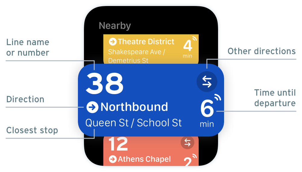
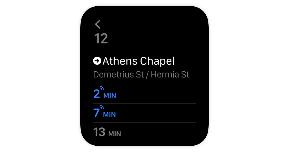
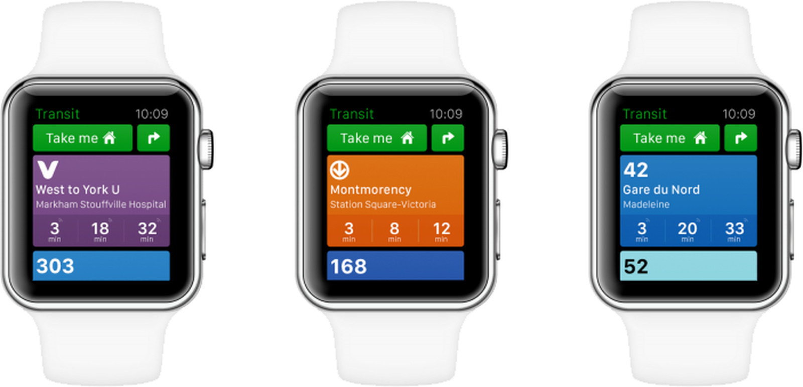
I would really like to see an app/widget like CityMapper or TransitApp that can show the nearby transit lines (like subway and bus) and their departure times based on my geolocation. Perhaps the ability to pin favorite lines. Both of these apps have WearOS/WatchOS functionality and would love to see it brought over to Garmin. I don't think we need all the additional stuff those apps can do such as start/end directions, turn by turn, etc. That's too much, in my opinion and I'll find my phone if I need to do all that. Is this doable or only something those companies can initiate? Is it possible to get something similar?