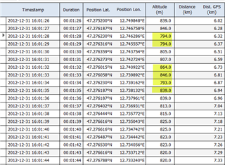
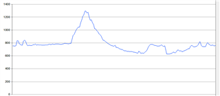
I drove a planned route 1300 meters in altitude yesterday. The Edge indicated over 2000 meters of altitude beforehand. Climbpro showed both gradients and descents as gradients. Is there a solution for this.
I drove a planned route 1300 meters in altitude yesterday. The Edge indicated over 2000 meters of altitude beforehand. Climbpro showed both gradients and descents as gradients. Is there a solution for this.