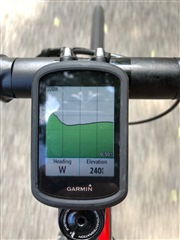
This screen shows up during my ride while navigating a route. What am I looking at? Is this the upcoming elevation plot? Is it where I've just ridden? (I suspect the latter since I took this photo shortly after a descent.) Is it supposed to show my current location on this graph somewhere? This doesn't seem particularly useful, so I am wondering how I am supposed to use this screen. (Can't find any reference to this in the user's manual.)