This discussion has been locked.
You can no longer post new replies to this discussion. If you have a question you can start a new discussion

Strava (not Garmin after all) broke climbpro

I've seen a few posts on this and made some myself, but I now have conclusive evidence that Garmin have broken climbpro in the transfer of routes from Strava (and maybe other platforms) to Garmin Connect.

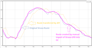
The problem is that Garmin recalculates the elevation data, but makes a mess of it. The image below is the elevation of the same route (via GPSVisualizer), one trace is  from Strava, and one is from Garmin Connect after transferring it through the API (favourite the route in Strava and it comes through automatically).

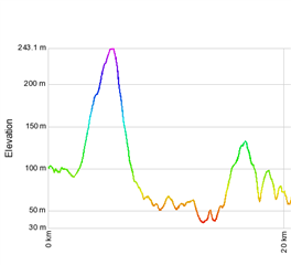
Heres the Garmin vs Strava elevation at the start of the route
and here it is at the end
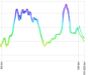
Heres the full trace, at the start of the elevation profile its fine, at the end its way out.

  • Thanks for the update aweatherall. I wonder what’s different in a route created from an activity vs manually. Maybe the number of datapoints or something?

    did a club ride this morning from a manually created route I made a year or so ago and synced to Garmin last night and everything worked fine, which was great. Hopefully this will be fully resolved soon for all routes. 

  • My Garmin Connect file is "hand made" , the official route on Strava is the one from the organizers, and it might be based on a ride (but I don't know for sure)

  • Thank you. You made this route on Strava or GC?
    The problem is when you make a route in Strava and sync it to GC. Then the elevation gets offset.
    I tested the route you gave to me on Strava. And that needs to be hand drawn.

  • OK well, the Stava one is from the organizer, the Connect is my handdrawn. That's  all I got besides my ride ....

  • I did some more investigation into this and the issue appears to be that at some point in the data set that Strava loads into Garmin Connect that the position and elevation data get out of sync or offset.

    This appears to only be with courses that are built from an activity. Not sure if it is possibly to do with data pruning from the original activity.

    Having the wrong elevation values assigned to a given location gives a distance displacement when you plot elevation over distance. 

    Here is the process I used, using the data from the Flanders course.

    I took the GPX course and exported it from Strava and loaded it on to an Edge so that it was imported and converted to FIT. This was so that I had the same coordinate system in both data sets.

    I took that FIT file and unpacked it. I took the lat/long and elevation data and put it into a spreadsheet. Lat/Long are in semicircles.

    I then took the course from Garmin Connect that Strava had created by loading a set of locations with their elevation data. Exported it as FIT.

    I unpacked the FIT file and put it on a second sheet. I then created a common key using lat/long so that I could take a position from the GPX sourced data and match it against a position from the Strava created route in Garmin Connect.

    There is no requirement that any of the position points actually match, depending on how Strava selected them, but most of the GPX sourced points are in the Strava created course.

    The elevation values from the the Strava Garmin connect integration are in integers so there are small differences with that from the GPX sourced data. 

    If the elevation data in both data sets is correct then taking any position from the GPX data and matching it to the same position in the Strava/Garmin created course should return the same elevation value. Within the small rounding error.

    I then pulled the elevation data value back from the course to be compared with the GPX sourced value.

    At first things matched within the expected margins, but then the Strava/GC course has elevation values that don't match and are actually wrong.

    If I take the lat/long value and look it up using a 3rd party tool. The value is close to that from the GPX sourced data.

    Here is one sample point that shows a significant difference.

    Lat/Long

    50.81064 3.58106

    The GPX data has an elevation value of 76.4 meters

    The Strava/GC course has a value of 11 meters

    If I feed the above lat/long values into the site below I get a value of 74 meters. This is close to the GPX sourced data.

    www.advancedconverter.com/.../find-altitude-by-coordinates

  • Thanks for your analysis of the issue.  I'm curious to try some of these other ways of looking at my data! 

    However, I've been having this problem consistently with routes that I *manually* create in Strava and sync to my 1040.  

    Typically the elevation profile gets more and more out of sync the further into a ride I get.  I've also noticed the climb graph altitude remaining lagging and sometimes freezing. I

    have not tested the issue on a route created from a recorded activity.

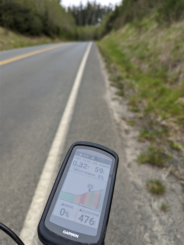
    Here's a view from the top of the last climb on my ride today!

  • Checking in on this and including a workaround, but with some caveats.

    Firstly the issue isn't fixed. On a 160km club ride to Brighton and back yesterday the elevation was off by 1km at the end of the ride. This is based on a route I transferred on Saturday evening.

    Secondly a workaround is to export the GPX from Strava and create a new route in Garmin Connect by an import of the file, instead of letting the API do its thing.

    The elevation isn't out of sync, but it does seem that there's quite a lot of smoothing when creating a route this way, and more than if you create a route manually in GC.

    The image is the elevation of Box Hill in Surrey, England, approached via Pixham Lane, and then the descent towards Epsom via Headley.

    The API transferred route (yellow) has a 1km offset (transfer bug), but the elevation profile is roughly the same

    The manually imported route created by importing the Strava GPX (pink) is in sync, but overly smoothed vs the original (dark blue) which is much more true to the actual elevation of the road.

    So there's not really a simple and effective workaround to the elevation bug, if you want good elevation data, draw the route manually in Garmin Connect. Creating in GC is good as you can also add waypoints for Coffee Stops (or pubs) which Strava doesn't support.

  • Hi for me is the same. Mostly the first climb is okay . But after a time it get more and more problematic. I have new maps and updated everything. But not help

  • Strava has confirmed that the issue is with the data they are posting. They are working on a fix.

  • Thanks for the update, I changed the title of the post. Hope we can get a fix soon.