This discussion has been locked.
You can no longer post new replies to this discussion. If you have a question you can start a new discussion

Off road maps - Spain

Hi team and members,

Really nice to meet you all, virtually.

I am new on this. I bought an Edge 1030 Plus. Getting used to it because it comes with so man features.

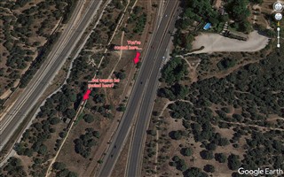
Last weekend I used it for the first time and it seemed that cycling off road the maps were not as nice as I thought they would be. Maybe I am doing something wrong or don't have the right maps actived or installed. Or this is what it is and I am clueless.

Well, the maps I have activated are:

  • INTL Standard Basemap, NR
  • Garmin DEM Map EU 2020.10
  • Garmin Geocode Map EU 2020.10
  • Trailforks 2020.20
  • Garmin Cycle Map EU, South West, 2020.20
  • Garmin Cycle Map EU, North East, 2020.20

Do you think I am using the right maps? Do you think I should buy another map?

Thank you very much in advance.

BR.

  • I had downloaded the "map" version (https://garmin.opentopomap.org/europe/spain/otm-spain.img), once I got the file, I had to rename it as "gmapsupp.img" and then I copied it the /Garmin directory of the device.

  • What „Routing mode“ is set in your activity profile?
    I have set „Mountainbiking“ but I think „Off road“ will do the same.

    As you can see on my screenshot: my Edge routes on the cycle way.


    I‘ve made this route on Garmin Connect, too (offroad), which routes on the cycleway, too.

    EDIT:
    As you can see on my screenshot: my Edge routes on the cycle way.

    It seems, I'm not right.
    I now have taken a deeper look into your screenshot and think - I know what you're meaning.

    See next posting!

  • See screenshots from Google Earth.

    If I'm right with my arrows and comments:
    It seems you have to navigate without turn guidance to achieve your goal!

    I've tried out some plannings, but all programs will navigate on the street - as long you plan a route and not a track.
    Even Basecamp with OpenMTBmap will navigate on the street.

  • Hello Mcinner1,

    Just one question and thanks in advance for the support.

    First of all. I have "gravel" as a routing mode.

    That said, navigating without turn guidance? How do you know then where to turn or go? I do not know if I made myself clear.

    Thanks again.

    BR.

  • There are more options to navigate with your Edge 1030 PLUS:

    1) let the device do the navigation - means:
    at some point you chose "navigation to" - let's say a city (Madrid) with "standard type of tour" Offroad.
    (my device does not offer offroad type "gravel", but only Mountainbiking, Offroad and Cyclocross)
    Now your device does the calculation and you follow the course.
    In that case it is always navigation with turn guidance and you cannot influence the course (only by chosing other calculation parameters)

    2) you determine the course by yourself.
    You can do this by several planning tools like Garmin Connect, Basecamp, RWGPS, Komoot and so on...
    The result of such planning is a GPX, TCX or cours_FIT file.
    Once loaded such a track/course file to your Edge you can determine if you are routed with or without turn guidance.
    A) navigation with turn guidance: your device loads the course and then it calculates all turns. This is shown on top of your device by counting the percentage.
    In that case the device can only follow pathes/ways/streets that are on the chosen map and are classified for use. If there are problems the device will deviate you to other ways/streets as planned.
    B) navigation without turn guidance: in that case you will see the thick magenta courseline and you have to follow by yourself. If you leave the course or miss a turn, the device will beep and say "off course".

    All following instructions are for saved courses you will load for navigation:

    To get courses on your device:
    The simplest way is to connect your Edge to your PC and copy the GPX or TCX file to Garmin/Newfiles folder on your device.
    (But nearly all planning tools offer "send course to device")
    Find enclosed a zip file with a GPX file I created for you. It's a 4 km long track from TRES CANTOS heading south, using offroad pathes.
    Copy that GPX file to the device Garmin/Newfiles folder. Disconnect your device (savely).
    After rebooting your device you will find this course under:
    Homescreen - Navigation - courses - saved courses

    When you see the course on the list - don't tap it now! First tap on the 3-lines button on the right side bottom.
    Now you can chose if you want turn guidance or not. You also can chose if you will be warned in case off-course.

    Try both guidance options - you will see the difference.

    TresCantosGPX.zip

    (Unfortunately I cannot check this GPX on my device to see what happens with turn guidance, because due to a bug in Beta 4.18 my device always will navigate to the start point after course calculation - and that's faaaaar away from Vienna...)

  • Hi Macinner1,

    Great and remarcable explanation. Thank you mate.

    I will try what your recommendation and let you know. If I get lost, you'll pay the taxi back home ;)

    Have a nice week.

    BR.