using mkgmap to change zoom level details

Has anyone had any joy using mkgmap (or any other method) to change at what zoom level things appear on the Fenix 7 maps?

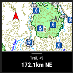
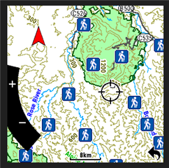
I have this persistent problem with huts and refuges not showing until I zoom right into the map, which makes it difficult to see them if I don't know exactly where they are.

(Toilets show up much sooner. Taking a crap has higher prority that sheltering from a storm?)

I've fiddled with the map details setting on the fenix but that didn't help.

Thanks!

NOTE: I have a blog about this at  Zoomies using mkgmap (terrycornall.wixsite.com) 

NOTE ALSO: I have found that some annoying contributions to OSM maps mark huts as an area but not as a point so this method of using mkgmap will not detect them. I will try to come up with a rule for areas that picks them up. Sigh. Consistency might be the refuge of the unimaginative but when it comes to databases of alpine shelters, I'll take all the refuges I can get! 

  • The best I have been able to do so far is to use this rule in the points file:

    tourism=camp_site [0x6412 level 0-5] #TChacked this to use a hiker icon visible at more zoom levels on fenix.

    It makes a "hiker" symbol appear at scales up to and including 8km, far better than previous best 300m.

    It appears that a combination of a particular symbol code and use of a level range did the trick. (I tried the same idea with different hex codes and got varying success.)

    Don't ask me to explain the logic here, it seems VERY strange why the symbol code has anything to do with the visibility at zoom levels, but it does. Maybe some symbols can only be represented at zoomed in levels because a graphic that is needed at more zoomed out levels isn't available? Dunno, I'm guessing here.

    Anyway, the hiker symbol, whilst not the most appropriate for a camp_site (or in my real use-case a wildeness_hut or alpine_hut) isn't too bad.

    I wonder if a custom symbol might work as well or better than trying to use the built-in ones? Maybe worth a try... Not sure what hex code to use though. Maybe 0x0000 thru 0x003f  (I'm guessing, based on the naming convention of 000.bmp thru 063.bmp for custom symbols)

  • I'm experimenting with  mkgmap to make a Garmin map from OSM data with just certain points of interest. i.e. camp_sites, wilderness_hut, alpine_hut and maybe some others, like water points, mountain summits. Also found a workaround that lets me see these points on the Fenix 7 at much zoomed-out levels instead of disappearing until you zoom right in.... (combination of certain icons and setting zoom level visibility. Oddly, it only works for certain icons.) The plan is to make it a transparent map so it can be overlaid on top of other maps with the usual tracks, roads and so-on. Here's a preliminary, with all the camp_sites for Victoria Australia shown as small blue squares. (Not the icon I'll use eventually) Also not transparent yet.

    Note that this image was  made using basecamp. The same file on the Fenix 7 produces 'hiker' icons not blue squares and also they disappear at above 8km as I zoom out. Which is fine, better than the pathetic 80 METERS I was getting using the Topo maps that come with the Fenix... I don't want to see them when really zoomed out anyway, just don't want to have to zoom almost all the way in to see them. Mind you, it would be nice if Basecamp and Fenix behaved the same for the same map...

  • That's a great idea! Please share your instructions once you are done.

  • I'm documenting my process at https://terrycornall.wixsite.com/website/post/zoomies-using-mkgmap for anyone to follow along. It's definitely a stream-of-consciousness thing at the moment but I'll post a final version at some point.

    Any suggestions can be posted to this forum.

    So far I have a transparent map that loads on top of Topo, with a hiker icon marking camp_sites (and eventually other things of interest to hikers, like alpine_huts, wilderness_huts  etc), that remains visible as I zoom out to 8km. Still working on getting sensible text to show the location name when an icon is selected. It just shows Trail for all of them at the moment.

    Like this screenshot taken from Fenix 7:  (Hey, when did screenshots go square? Didn't they used to be round!)

  • I don't have access to the content of the link. Does it need a subscription to confluence?

  • Really nice work. I'll hope for some time to join you.

    Didn't they used to be round!

    Not since f5x, when I jumped to the fenix line.

  • Didn't they used to be round!)

    Sorry, I was wrong. I went back among my files and at 2017 I've round examples.

  • So I got names to appear now but only when the point is selected. I had to add a rule effectively saying "The name is the name", which is silly... so all that's in the points file is now:

    tourism=camp_site  [0x6412 level 0-4 default_name 'campsite' continue] 

    <finalize>
    # The finalizer section is executed for each element when a rule with an element type matches

    name=* {name '${name}'}

    I'd like the name to show even if the icon isn't selected, but maybe at a more-zoomed in level...( It does this in basecamp, but not on the Fenix)