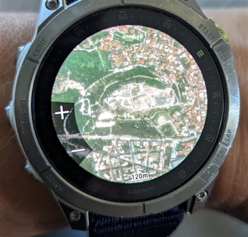
This thread is about the new Maps + feature available for the Fenix 7 / Epix 2 series.
My plan is to keep this OP updated with new information as we learn more.
I've already purchased a Maps+ subscription ($50/year), and played with it a little. Here's what I know so far:
- Maps+ is a US-only feature currently. No idea if Garmin plans to roll out other countries / regions in the future, or when that might be, but currently if you are not in the US, or don't spend any time in the US, then you can ignore this thread and the new Maps + feature.
- The maps can be downloaded with up to 6 different layer types, with things such as private land boundaries, satellite imagery (similar to the now-defunct Birdseye Imagery), and other advanced layer types
- You can decide which layers you want at the time of download, so you can omit certain unneeded layers to reduce the download and storage size.
- You can toggle layers on and off in each activity's settings.
- You can download everything (including the satellite imagery) directly from the Map Manager app on the watch! No need for clunky Basecamp software. Unfortunately, the watch is currently the ONLY place to download Maps+ stuff, there is no integration with Garmin Express, Connect, or anything else yet.
- You must have touchscreen turned on in order to change the region location/size you want to download.
- There is a size limit on each download, though it's not clear what it is. Sometimes I can download like 100 square miles at once, other times it won't let me download more than 9 square miles. As far as I can tell, there's no way to know how big of a region you can download until you get a "map size limit exceeded" error. For the most part, it always fails when I select a region at larger than 3-mile map scale.
- The plan can only be used by one compatible Garmin device but can be transferred to other Garmin devices.
- The satellite imagery works better than Birdseye - even though it pretty much looks the same, the watch does a better job of rendering it quickly, and it also is viewable at ALL zoom levels! Classic birdseye imagery only showed up at certain zoom levels, and was often slow to render.
- It's a bit buggy currently. For example, the size estimates are all over the place. It'll tell me it's 2.5GB for a small 1 square mile area, and then if I zoom out to 100 square miles it estimates 150mb. From what I can tell, the size estimate is not reliable at all, you kinda just have to download it first and then see what size it ended up. Also I've experienced a couple watch crashes while playing with the Maps+ in map manager, and while turning on and off layers in an activity.
- Some map layers (parcel, public lands, hunting units, etc) appear to download the entire state regardless of the size of the region you highlighted. For example, I only downloaded a small region around my house, but when I turn on the Public Lands layer it shows that layer for the entire state. I suspect that when you download multiple regions, it downloads a copy of that entire layer for the entire state, every time, resulting in way more storage space being used than necessary. So it might be best to only download your first region with all the layers turned on, and after than only include 1 or 2 layers (like Satellite imagery) in subsequent region downloads.
Here's a link for product info: https://www.garmin.com/en-US/p/893561
And a link to the support article: https://support.garmin.com/en-US/?faq=eEU6gvM2eX53qJBQD6bkn5&partNumber=010-D2098-00&tab=topics&topFaq=true


