Hello,
Can you help me with this option? What should I do activate it? How can I do it? Do I need some predefined course to use it?
Thanks for your help  ️
️
Hello,
Can you help me with this option? What should I do activate it? How can I do it? Do I need some predefined course to use it?
Thanks for your help ️

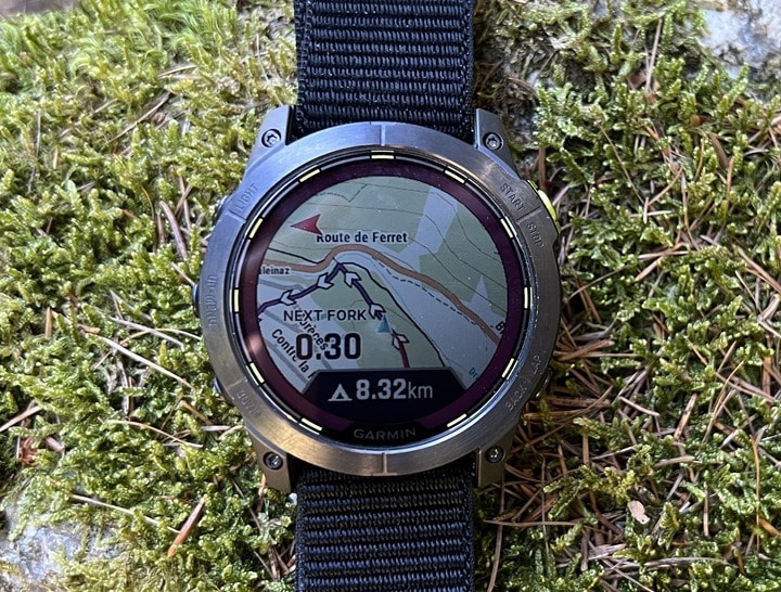
Navigating a route is a requirement for NextFork
Yes, I have seen this statement in the Data field appendix. But it is a misprint. The function certainly works independently of navigation…
![[Redacted]](https://forums.garmin.com/cfs-filesystemfile/__key/communityserver-components-imagefileviewer/system-images/anonymous.gif_2D00_44x44x2.png?_=637467835002628330)
You have to add the Data Field to a Data Screen. You can also add it to your map screen, you just have to change the layout. The NextFork Data Field can be found under Navigation Fields.
www8.garmin.com…

It's literally just an added aid to know what's coming up... So say your using a course and navigating... and next fork is 0.2 miles away... But your not making that turn or fork, your course says next…