Fenix 7 is advertised as an ultimate adventure watch but the maps have poor readability for activities on trails

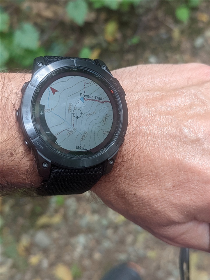
The above picture shows my frequent frustration when trying to use maps on forested trails. This picture was taken in the middle of the day while running on a forested mountain trail.

Can you see the trail going to the left without zooming the picture? I can't. And this is what Garmin calls High Contrast map theme. I actually took some time to get rid of the glare and reflections before taking the picture, but even without that trails are hard to see when not in a bright sun. It is even harder to see when moving faster e.g. trail running. 

The main problem is that trails are rendered with a single pixel wide dashed line and that just doesn't stand out enough especially when there are a lot of contour lines. What Garmin should do is to render trails with thicker lines. If Garmin doesn't want to do that by default, perhaps that should be done in the High Contrast theme only.

Can anyone from Garmin comment about this? By the way, Enduro 2 is going to have exactly the same issue.

  • The issue for me is more the quality of the maps than anything else. This quality varies greatly depending on location. Pretty poor here in NZ for instance so no matter the controls we won’t see the tracks as they are not on the map. 

    As for the visibility. Well I have old eyes and very short-sighted but now also long-sighted. It's got to the stage that I have to take my glasses off to see information on the watch at the best of times.

  • I found my area seriously lacking too, I decided to add to the OSM project myself by adding missing tracks, paths, buildings etc... then companies like Garmin, Frikart, Talkytoaster etc, pick up the changes when they update their maps...not a quick easy solution I know, but it was the only way, not many people are working on the OSM project in my area unfortunately, I got tired with the lack of detail so I did it myself lol. 

  • Yes, Garmin relies on the OpenStreetmap project to get the forest track into their maps, and that depends on users adding missing tracks to OpenStreetmap. In many cases there's very little Garmin can do, since available "official" maps have even less forest tracks than Openstreetmap. I know this, because where I live (Finland) the governmental National Land Survey of Finland has somewhat good forest track coverage in its maps, but still the free map I'm using adds tracks from Openstreetmap on top of the official maps to improve map quality. Slight smile