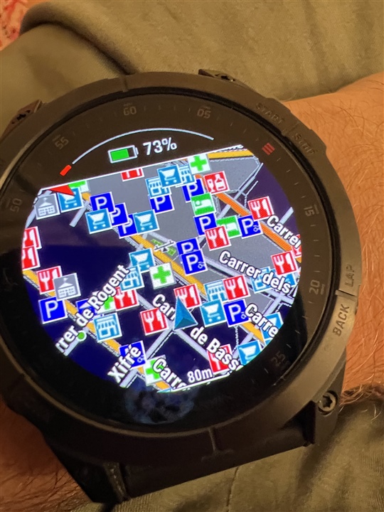
When using the maps in urban areas, the shear number of labels pretty much obscures the underlying map data. I get so many P labels and public transportation labels, which have limited use when running, that I can’t really see the map. Is there a way to remove those labels? I’ve only used the European maps so far, not sure it happens elsewhere as well.