Today I did an interesting test and I want to share the results.
- garmin instinct 16.0
Part 1
-In my house I calibrated altimeter and barometer with "GPS option", 1338 meters above sea level. It's ok, it's the real one.
-without using the activities, I have driven to the sea, 130 km of displacement.
-The GPS altitude dropped steadily, almost the same as the one my car has installed. I appreciated very good data
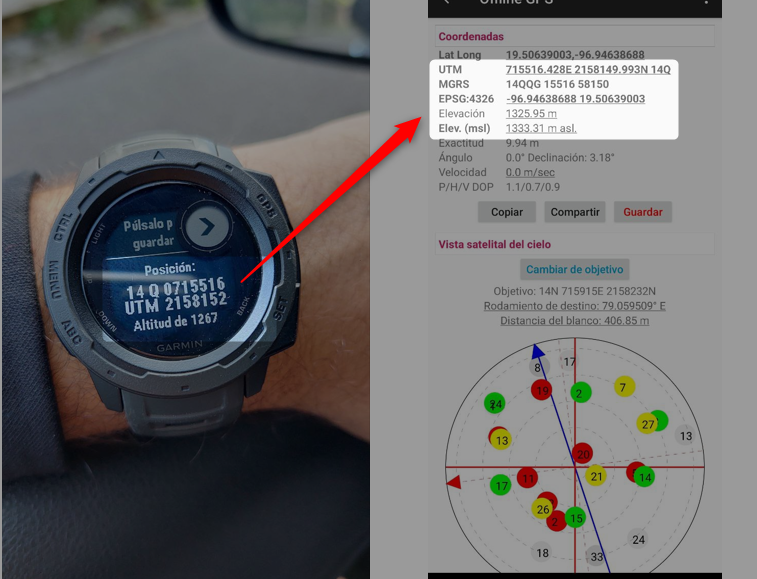
-I arrive at the beach, and while my low-end cell phone, with a UTM viewer application, indicated 3 meters above sea level, the garmin gave 70 meters above sea level..... why is there such a huge difference? DATUM is WGS84
Part 2
-on the beach, I calibrate again altimeter and barometer with "option" GPS, at 4 m. All ok I think.
-I get home, and the garmin indicates 1275 masl, instead of 1338 masl
1) why is this happening?
2) is the GPS included in low-end cell phones really better than the one with a garmin watch?
Thank`s