Waypoints and Course Points and custom POI export to the Watch

Hey,

first of all I want to make clear what I'm meaning when im talking about Waypoints, Course Points and POIs.

I want to use Basecamp as my planning Software.

Waypoint:

Just one of the Rout-Points I need to create a Track in Basecamp. One follows the other and I get a Track with an Starting Point and a Destination. So it's just the Track I want to Hike.

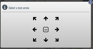
So It's just part of the turn by turn navigation,
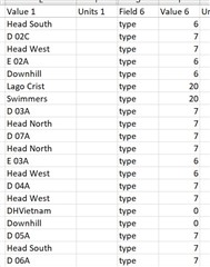
Course Points:

Interesting Points on the track, which I've planed. Like Houses, mountain shelter, water-points.

There are a Data-Fields on the Fenix like "Distance and Time to next Course Point". And I want to know how much distance there will be to reach the next Course Points
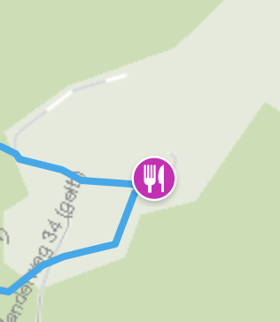
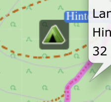
Custom POIs:

I want to great Custom POIs like camping-sites or emergency shelters in the area I'm Hiking.

So If the weather conditions changed dramatically I could navigate to that point, although it's not part of the track I planned before.

Question:

Im able to plane and transfers Routes with GC, GE or Basecamp.

But there are Features in GC which I Need in Basecamp. So How could I combine alle of these?

In GC I can add Coursepoints on Tracks which I created in Basecamp, but no custom POIs.

In Basecamp I can add Custom POIs and export it to the Watch but no Course Points.

So how can I create a Track with all of these Information an export it to the Watch?

  • Well, had never used plotaroute before so I didn't know about McBadger fit fix for it. 

    I did a further test and realized that Plotaroute has only nine  of 25 turns warnings available... but it is something.

  • Actually there are a few more.

    See this forum post:

    I think we've got to the bottom of this now!  We've made some more changes that should enable the use of course point types in FIT files that aren't supported in TCX files, so this includes:

    • Slight Left
    • Sharp Left
    • Slight Right
    • Sharp Right
    • U Turn

    We've also added support for the following course point types in both TCX and FIT files:

    • Summit (plotaroute Mountain symbol)
    • Water (plotaroute Drinking Water symbol)
    • Food (plotaroute Food symbol)
    • Danger (plotaroute Warning symbol)
    • First Aid (plotaroute First Aid or Ambulance symbols)
    • Sprint ((plotaroute Runners symbol)
  • There are only 9 "Turn Arrow"s at Plotaroute and several "Symbol"'s

    Only the the "Turn Arrow"´s follow ANTSDK format/type. Symbols are not...

    Also if you choose a Symbol Plotaroute is changing course_point's original names...

    See a sample table bellow:

    First line: type 6 is for LEFT and "Head South" is the modified course_point' name done by Plotaroute...

    Second Line: type 7 is for right so is correct . I did not choose any symbol therefore the name was not changed. Which is what should happen IMHO.

    Where did you find those bellow?

    • Slight Left
    • Sharp Left
    • Slight Right
    • Sharp Right
    • U Turn

    We've also added support for the following course point types in both TCX and FIT files:

    • Summit (plotaroute Mountain symbol)
    • Water (plotaroute Drinking Water symbol)
    • Food (plotaroute Food symbol)
    • Danger (plotaroute Warning symbol)
    • First Aid (plotaroute First Aid or Ambulance symbols)
    • Sprint ((plotaroute Runners symbol)

    Best regards,

  • Only the the "Turn Arrow"´s follow ANTSDK format/type. Symbols are not...

    If you choose one of these symbols instead of a turn symbol, plotaroute use the correct antsdk is for it. When I use them I get the correct symbols on my fenix 5x or 6x watch.

    • Summit (plotaroute Mountain symbol)
    • Water (plotaroute Drinking Water symbol)
    • Food (plotaroute Food symbol)
    • Danger (plotaroute Warning symbol)
    • First Aid (plotaroute First Aid or Ambulance symbols)
    • Sprint ((plotaroute Runners symbol 
  • Also if you choose a Symbol Plotaroute is changing course_point's original names

    Yes, texts are the one that are written in the Notes field. If you don't enter anything yourself, there is a default and if it is a turn on the map with a street name, the street name is included. What is written in Notes field for first line?

  • All my waypoints at Basecamp have empty Notes. I only use Name.

    Here are my findings testing plotaroute after your comments:

    1- Use Symbol or Turn Arrow, not both, and make sure to set the other to "i" or to "none" respectively.

    2- No matter if you fill both "Directions/Notes" or "Label" Plotaroute wiil cut it somehow...

    3- Plotaroute will try automatically to set a Turn Arrow not always right so you need to double check it and set to none when you use a Symbol.

    4 - Follow bellow an schedule to use it. Despite not having them all  and this thing of use arrow or symbol it is good start.

    Type Garmin Plotaroute Symbol/Arrow
    generic 0 none none
    summit 1 Mountain none
    valley 2    
    water 3 Drinking Water none
    food 4 Food none
    danger 5 Warning none
    left 6 none Left
    right 7 none Right
    straight 8 None Straight on
    first_aid 9 first_aid none
    fourth_category 10    
    third_category 11    
    second_category 12    
    first_category 13    
    hors_category 14    
    sprint 15 Runners none
    left_fork 16    
    right_fork 17    
    middle_fork 18    
    slight_left 19 none Bear left
    sharp_left 20 none sharp_left
    slight_right 21 none Bear right
    sharp_right 22 none Sharp right
    u_turn 23 none Turn back
    segment_start 24    
    segment_end 25    


     Regards,

  • Great compiled table of course points.

    Comments on your points.

    1. Never have had any problem if I select an arrow OR symbol. If I select both I've had some unpredictable results.

    2. I've not used label, but I thought that was not used in fit file at all. Tested the length of course point description that my watch (5x) could handle at the time and it was 15 char. Plotaroute give me that, but I didn't test max in plotaroute. 

    3. Yes. I always need to go through the direction list and double check that the auto generated is correct. My conclusion is that the auto generated text is a lot more correct. If I'm in a hurry creating the route, I just check/change the turn symbols to the same as the direction text. Hopefully there are some improvements on the way.

    4. As said, great summary of all available types.

  • This is very good. I was not aware of this "Gimporter" widget:
    https://apps.garmin.com/en-US/apps/de11adc4-fdbb-40b5-86ac-7f93b47ea5bb

    Back to the original post question with this widget I was able to take a GPX file which includes waypoints and import it to my Fenix 5 watch with the waypoints converted to course points. Amazing.

    FYI you need an Android phone with GExporter installed that communicates with Gimporter widget on watch. 

    (No longer need to deal with Plotaroute which can also  convert waypoints to coursepoints.)

    The other way to be able to upload tracks with coursepoints for me was the Plotaroute web app:

    www.plotaroute.com/uploadroute

    Here the challenge is to get the  created FIT file which contains the coursepoints copied directly to the watch's "NewFiles" folder for which you need to connect your watch to a PC wih USB.  So the 1st option is much easier.

    Why we had to to all of these tricks?

    Because Garmin Connect import does not support coursepoint import, only the track itself.Tired face