This may be a beginner question so apologies in advance, I took time to search the web and the forum and look at similar topics, spent 4-5 hrs on this, but I still felt it would be helpful to ask this directly from the more advanced users so I appreciate your help.
So I went hiking a certain trail and I was going to use my Garmin Fenix 6 watch for navigation, but that trail system or the nearby campgrounds (which are even present on google maps) were not shown on my watch's map, even though I could see them on the online connect.garmin.com map.
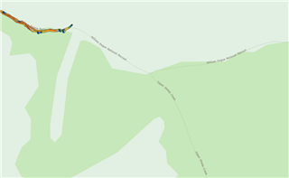
Here is a screenshot from connect.garmin.com if you activate the "HERE" map:

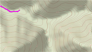
Here is what you see in the watch, using Garmin's TopoActive:

So thinking that I could get the trail system if I buy a Garmin GPS unit, I bought the GPSMAP 66i, only to find that (correct me if I'm wrong) it doesn't come with anything more than the map that I had on my watch! No trail system (in this area) no campsite no Hotspring nothing! Just a topography map.
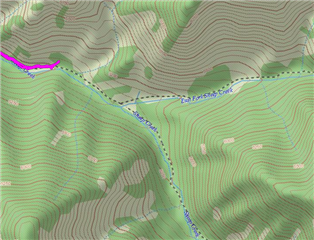
Upon searching this forum, I found my way to explote.garmin.com, where on the "map" tab, if I activate the "Topo" option (not "TopoActive" option) I will get this:

which as you may notice, includes the trails, but not the correct trail names (compared to the "HERE" maps)
So here are my questions:
1. Is this last screenshot, what I would get if I pay for the 100$ Garmin 1:24 maps? I should ask this because I didn't find any way to check the map (to see if it includes the trails I'm looking for) before I buy it.
2. Is there any way to get those "HERE" maps on the device? (the first screenshot)
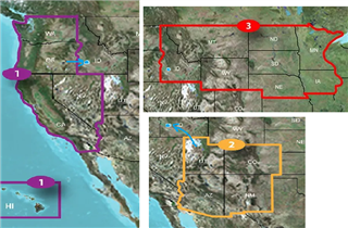
3. (most important) this is expensive! I live in Boise Idaho. So If I want the Idaho map I should pay 100$ to get the North Central map. If I want to drive 1 hr west or south to hike there (which I do) I should pay another 100$ to get the West map. If I want to drive 4 hours southeast to hike or backpack, I should pay another 100$ to get the southwest map. Take a look:

That is 300$ just for maps for my 4hr drive radius, on a 600$ GPSMAP device that I thought should already come with better maps. And from what I've read here and there, those 1:24 maps are spotty and old, and may include or not include many trails. So my question is this: Is there any better (cheaper) way to load reliable trail maps onto this device, or get a device that comes with better maps? What are the more advanced users doing!?


