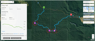
I have a 5x Plus, and I bought it for trail/ultra running.
So I'd like to be able to plot a track, mark points on it for food/water stops or checkpoints etc.
So (at least as far as the Web side is involved)
Explore:
Not very good at plotting tracks, but will create waypoints. Import a route created elsewhere - no elevation profile. Syncing to watch is a bit painful
Connect:
Better at plotting tracks, but no waypoint/checkpoint support. Sync's very easy
So right now I have to create a track in Connect, import it into to Explore, add the waypoints I need, delete the track and just sync the waypoints to my watch, and then use Connect to export the route/track to my watch,
Is it me, or is this a little absurd - or is there a better way?
Been using Basecamp but thats got even worse plotting capability than the other 2.
EDIT: I meant track not route. My fault for being semantically unclear!


