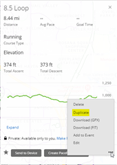
I planned a course in Garmin Connect Web.
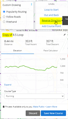
After that I duplicated and then reversed the course to save the counter-clockwise direction as separate course (reason: when I just navigate a course in reverse direction on my Forerunner 945 LTE, it won't give me any turn signals. So I have to explicitly save the same course in reverse direction).
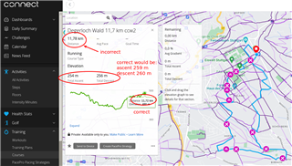
Immediately after just clicking reverse direction, the distance shown increased from e.g. 11.7 km to more than 20 km. Also, the total ascent and decent more than doubles (from 260 m to 530 m in my example).
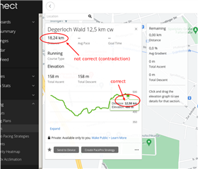
In another example, the distance increased from 12.5 to 18.2 km, while the total ascent and descent did not change (see screenshot below).
Please remove this bug.
Note: My course also included a few manually set course points - not sure if this is related - just saying.
Update: Seems the bug only shows up when I keep the selection at its default "popularity routing". When I select "Freehand" before reversing the route, the problem does not show up. Note that I planned the original course in Freehand mode.
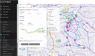
Update 2: For my 11.7 km course, the problem ALSO shows up when reversing in "Freehand" mode. So there is noting that I can do as a workaround! Really bad. Here the "before/after reversing" situation:

I did the duplication and reversing another time (again after selecting "Freehand" before) - this time with another wrong result ("better", but still very wrong):

Update 3: I found that the bug is already present after the duplication: IF I just take the duplicated course and change just one tiny part of the course in Freehand mode, like moving the route by "1 millimeter" at one point, the course distance jumps directly from 11.7 km to 20.7 km and the total ascent / descent changes from 260 to 530 meters, and the elevation diagram start to look very noisy. Something is completely messed up with this tool! Please fix it!
Update 4: An "ALMOST"-WORKAROUND:
- Export track (i.e. save on computer locally) as gpx file
- Re-import this gpx file and then select "Freehand" and then reverse the course
This "almost" works. Also here the course changes its length, but only slightly from 11.72 to 11.78 km, and still with the inconsistency that the total distance (11.78 km) does not agree with the elevation diagram (correct 11.72 km). And again the total ascent/descent change without reason - this time it becomes 4 to 5 meters LESS:
Update 5:
When I export the "almost correct" course to a gpx file and re-import it, then the re-imported course is fixed. A very cumbersome workaround...