
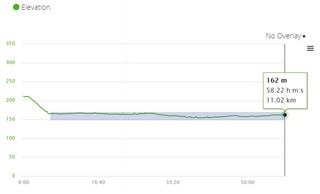
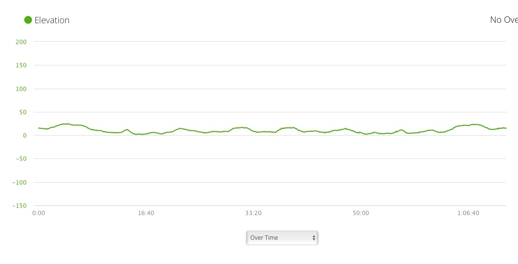
Is there anyway to change to range of elevations shown on an activity in Garmin Connect for Mac. My runs always show from +150m to -150 in elevation yet the highest point locally is only 45m elevation. It makes the graph look flat as all my runs are in the 0 to +50m range.
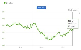
See the attached screen shot. Strava shows this is 89m climbing with a large incline at start and finish yet Garmin shows it near flat. ciq.forums.garmin.com/.../1466215.jpg

 I agree fully to this. There are posts going back 7 years here and nothing has been done about it. I train in an area that is mainly flat - highest point about 40m but on Garmins scale I can't see any much up and down at all as it only really shows in increments on 50m and nothing much in-between