I am new to boating and I am having a hard time figuring out how to put waypoints in to Homeport. the waypoints that i have look different than the coordinates on the software. Example I have 14096.9 46895.9 2957.95N 8537.31W. How do i put this information into Homeport?
I would first find out what grid those strings are using. If this came from a software application, its Options/Preferences should tell you this information. If it is from a website, they probably advertise what grid was used.
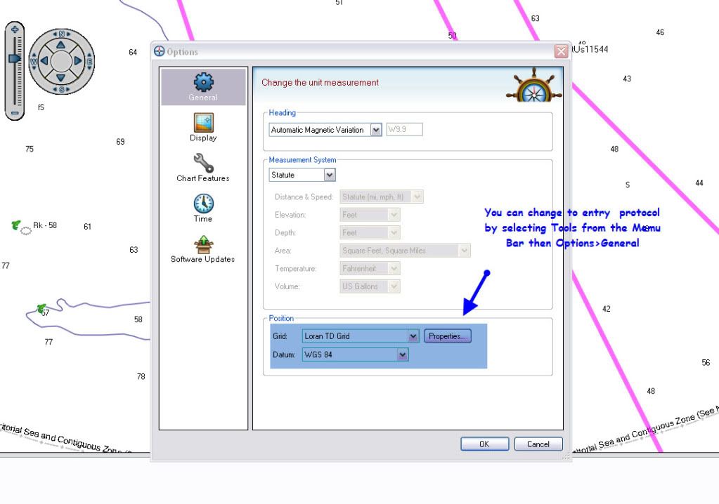
To see the list of Grids/Datums that HomePort supports, go to Tools->Options->General->Position. Once you know what grid your input string is, you can set that as your grid in HomePort, then go to View->Recenter Chart and paste the position string. You can use that dialog to recenter the screen to view that position on the map and/or create a waypoint at that position.
Those WP's look to be in Loran TD format as opposed to GPS Lat/Long format. You will have to either convert the WP's to GPS coordinates using software (google search for GPS utility software), OR, change the position format in Homeport to Loran TD's. However, there is a bug in the first release of Homeport where making changes to units of measure (where you would change the postion format) causes problems. So I would not advise changing that in Homeport until Garmin fixes that issue.
loran TD's you change you datum to relfect the Loran datum for your area of operation.
You can find the correct map datum and loran chain information of the paper chart of your area.
Here's how to change the format to Loran TD's. Remember, when you change to Loran TD's for entering data all your wpt numbers will be Loran TD format. Once you finish entering your Loran numbers you need to change back to lat/long and change your map datum back to the GPS one for your area.