Hello World,
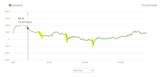
Im struggling to get FR945 altimeter to actually work and give reasonable measurements, but regardless of what I try, what options do I switch on/off, there is always an increase or upward drift in the elevation data for the first 10-15 minutes of my activities. I can't figure out why this is happening. The area is mostly flat. Strava maps and OSM give the same elevation profile and it's completely different from Garmin's. See the route bellow for example. It's a symmetrical one. The green profile is the elevation recorded by Garmin. The gray one is from Strava/ OSM. There shouldn't be more than 10 m elevation gain...
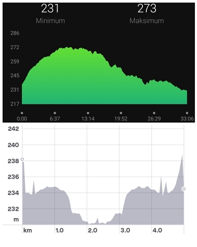
I used automatic calibration, manual calibration, only barometric altimeter, only altimeter data... I really tried every possible combination I could think off. Nothing works. Recently I switched to minimise elevation option and at least the end of the run looks somewhat I would expect to see. Still, it is far from acceptable.
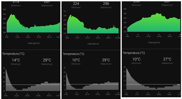
I also did the Baro Test and the barometer is working fine (or at least the system is saying that it is valid). For distance and speed I use Stryd data, because the tempo profile from Garmin's GPS was pretty much unusable garbage, especially when I run in forest on a cloudy/ rainy day.
I found several similar topics, some quite old, some new, so the issue isn't something that would surprise Garmin. But it seems like there is no solution for this problem and Garmin just doesn't want or can't fix it. So I would like to ask if any of you is experiencing similar problems with your fr945? Or is it just bad luck/ defective model (2.5 yo)? Also, other members of my family have Fenix 6 and Fenix 5 and their elevation profiles look perfectly fine.
Cheers!
P.S. Of course, I can always correct the elevation data in the browser, but doing so from outside Connect App is retarrded, especially when one has to correct every single outside activity.