You can no longer post new replies to this discussion. If you have a question you can start a new discussion
GPS issues Open Water Swim
Former Member
My GPS is wonky each time I do this swim and tells me I've swam on shore. I'm swimming about 200 yards or more from shore. Is there a special GPS setting for Open Water Swim?
Track is pretty reasonable for the 945. Maps do not always align up with GPS coordinates from watches. When swimming that close to shore you also have tidal issues. Try looking at the different map views. Also look on Garmin Connect interweb.
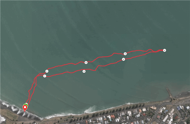
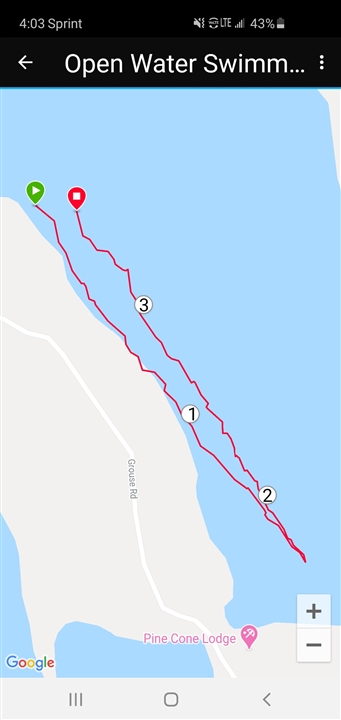
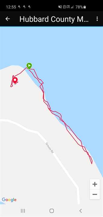
Not that I doubt you but are you sure you are 200yds offshore, or just think you are. For example, this is my regular swim which involves swimming about 230m from the shore to a buoy before turning to swim down a line of buoys: Track is from an F6 but I do have similar tracks from a 945/
Thanks. I have gotten 3 different readings on virtually the same swim, so maybe weather is a factor. Today I had it set to GPS+GLONASS, but maybe will try just GPS. This lake swimming, so Im swimming well out beyond people's docks, etc.
Missed the bit about GPS settings. I have GPS+GLONASS on and it works well enough for me that I've not tried GPS or GPS + Gallileo. If you are not on 1s recording try setting that as the tracks are often better than when recorded with Smart recording (the default).
Two hundred yards is a long way offshore as you can see from my trace so perhaps you are not as far offshore as you think. If you're confident enough try swimming straight out and see what 100m looks like and further if you can.
The key point to understand is that maps do not always align with the GPS tracks recorded for a number of reasons so when you are close inshore you can get the track appearing on land. Note also that GPS errors will be amplified in the water too. Whereas you might expect 5m accuracy on land this will be much more when swimming.
Try setting an autolap and see where the laps line up if you have reference points. I'm lucky as I have buoys at 250m intervals. This is a 945 track. The numbers on the map represent the 250m laps. which as you can see are pretty close despite my less than accurate swimming that day- it was a bit rough and the sighting marks were difficult to see in the swell and chop.
I have GPS+GLONASS but found that in this part of the world at least, that it did not really matter too much. The tracks you have are pretty much what I can see between swims. I find it very much depends on sea state - rough or calm - and weather. And of course there's also the position of the satellites that changes from day-to-day and hour-to-hour. Lots of variables.
And changes between software versions too. But overall. I think I have more good tracks than bad. Certainly changed a lot since the first swims when there were issues keeping hold of the satellites.