Why my Edge Explore 2 with latest firmware does not show all of the user added course points?

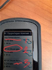
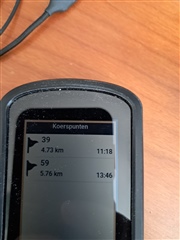
While planning the course in GC I add 5-7 course points to get general idea how far I have remaining to those checkpoints. The issue is that out of that 5-7 points, when I start the course, not all of them are shown on the list.

Any idea how to get around this?

  • Check if Course Point display is turned on. It is an option and the control for it is under course settings, but only shows once a course is loaded.

    On a 530 it is here but I assume the EE2 will be similar:

    Menu>Navigation>Courses>[Load a course]>Settings>Course Points

     You might also find that the Course Pt Distance data field is useful for counting down the distance to the next course point as you ride.

  • The case is that I have this setting is "on". I thought that non-standard characters in the point names could be the culprit here, but after I modified the names, the issues persists.

    Am I the only one experiencing this?

  • Hi  and Peter! I experience somewhat the same.

    Just to be sure, we discuss the same issue: I use several tools to plan a tour/course/route (name of the gpx/fit depends on the tool I use). Then I send it to my Edge Explore 2 via Bluetooth, either or not by using GC app or web.

    Then, I experience one of the following:

    1. The course keeps the course points. They appear as list in a data field Course Points, on map and are navigable; i.e. I can get distance to the next Course Point.
    2. Or I only get a few of the Course Points
    3. Or I only see the Course Points data field during loading the course
    4. Or I don't see them at all.

    By Course Points I mean points that I add to the course, give them a name and - if possible - a symbol. For example: a restaurant I will have a stop, a POI on the course I don't want to miss, or a node in the Dutch Knooppuntennetwerk.

    Tools I use:

    1. (Preferable): The 'create new course' on the Edge Explore 2.
      When I add a Course Point, I can see it in the list underneath the altitude graphic including the name I gave and I see it on the map, as long as I stay in creating mode.
      But after saving this new course and riding it, the course points disappear, never been able to get them back again.
    2. (Also preferable) Apps either on Ubuntu laptop, Android mobile device or WWW: QMapShark, Fietsersbond Routeplanner, OSMAnd. And send the course to the Edge via Bluetooth.
      This is the alternative that gives me best changes to get the routepoints on the Edge Explore 2.
      But I experience the four points above.
      And I haven't figured out yet, how to make this work all times.
    3. GC, either app or web-app.
      Athough it doesn't quite suite my needs, I've tried to make a few routes with Route Points. They points always disappear when I transfer them to the edge via Bluetooth

    I've already spend quite a few days on getting to know the right procedure. 

    But since I still don't know what makes it work or not, I still haven't figured out.

    So I serious hope, someone can solve this issue!

  • Things to note are:

    GPX files do not support Course Points, so TCX or FIT must be used.

    POI’s (Locations are the term Garmin uses on the Edge) near your course are not course points but separate entities. Locations that have been saved on your device will show on the map only.

    Custom Course Points can certainly be added to a course created in the GC web app and saved in the course fit file. I haven't used any of the other planners mentioned. The method of sending to course to the Edge won’t be a factor in determining whether you see Course Points or not.

    1. GPX  and Course Points: I've made .gpx files, holding coursepoints - i.e. points I've named and given a symbol and are part of my course/route. I've imported them into GC web-app and send them to my EE2 by means of Bluetooth; these courses  on the EE2 still contain their course points. 
      I have some files as examples, but don't know how to upload them to this forum. Instead I added some screen shots in  reply  on this post.
      Btw: I guess these gpx files are converted into .fit files; although don't know where, i.e.e either by importing them into GC or by sending them . 
    2. POI: agree by POI in this context i mean: a POI on the map that my course crosses or nearby the course. I then make a Course Point myself on the course, as a reminder to that POI.
    3. I noticed that  the Course points sometimes disappear when importing  a file into  Garmin Connect (Web App),. So agree: sending a course  from GC WebApp to EE2 probably doesn't delete course points.

  • Some screenshots and explanation what you'll see

    1. Three courses on edge explore2; two ahave origin .gpx files and one is a .fit file.
        I imported these files from local file folder (i.e. laptop) into Garmin Connect Web App and send them to EE2 via Bluetooth. I guess, somewhere on this path, the files are converted into .fit files, allthough I didn't verify it)

  • 2. I created a course with course points on Garmin Connect Web App, exported it to local filesystem - either as .gpx or .fit -, and imported those two files back into Garmin Connect Web App. These are courses 2 and 3 on picture above
    As fit-file is the Garmin Edge standard file format, I'll thrust you'll believe me that it exported well.

    So this picture and next shows the .gpx content after importing in GC WA and sending to edge.

    This picture shows one of the course points on the map

    3. And this one shows the datafield with all of the course points for the loaded course

  • 4. Picture 4 en 5 show course 1 on list in point one above.

    This course, I created on Fietsersbond routeplanner - NL/Dutch

    This route planner gives you some route-options, for example "Knooppunten"=Numbered Nodes

    I exported it into a gpx route file (not track!) and had to edit the tags in the gpx file to get the nodes-numbers into the right tag, i.e. nametag as they where exported in a description tag (as I remember well) 

    This picture shows one of the course points

  • 5. And this picture shows the list in the coursepoints datafield with (only!) two of the course points

    The disappearing of some of the course points is due to where on the course I started; as the points that are being shown are the points on the remaining of the course.  The other are history, as if I'd already passed them by. Although little bit pity they disappear, I understand Garmins design.

  • BTW Picture 3: notice (1) the order off the course points and (2) the distances, being 0. T experienced this, when not  on course yet. F.e. staring somewhere else and fisrt navigating to beginning of course.

    Note: this picture was taken from  map when selecting the course (i.e. courses/select course/<course loaded>/click on course / <map loaded>