This discussion has been locked.
You can no longer post new replies to this discussion. If you have a question you can start a new discussion

Total elevation gain different from Fenix 5X+

First ride today with my brand new 840 Solar, yeeha.

I chose to ride a standard round which I have cycled before with my handlebar-mounted Fenix 5X+. I cycled this round multiple times, on different days.

Now it suddenly turns out that I have cycled 130 more meters in altitude... In Garmin connect i can I can simply pick the file recorded with the Fenix out from the rest based on distance and altitude meters, without opening everything, so stable are the figures of this course, of course within som margins.

Elevation correction is turned off (because barometer, same on the Fenix). Min and max heights are more or less the same (small deviation, but it seems that this stays during the recording) Auto calibration is on (same on the Fenix) and altitude profile looks the same. Yesterday I soaked the Edge to get the GPS working.

The course (from Komoot where I got it from) loaded into Garmin gives almost the same altitude data as after I rode the course with the Fenix. So the Edge is the one that deviates. A little deviation is normal, but a total height difference of 130 meters is significant. If the min and max altimeters had been different, I would have looked there, but now I don't know what is wrong.

Checked the barometer port on the Edge, but that is spotless (well i didn;t expected anything as it was the firts ride with it).

It is also noticeable that the course that I ride was made in Komoot. The elevation gain that is stated there is more or less the same that the Fenix recorded on several rides 

The course is in the woods/open field. No buildings, no mountains or deep cliffs that can cause some errors.

Any ideas?

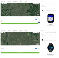
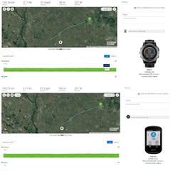
  • I already wanted to raise a ticket about it at Garmin Support, just i had no time yet. When the terrain is flat or false-flat, the Edge 840 (but i think all x40 model) is calculating much more "total ascent" (and "total descent" too) comparing to 965 or Fenix3 or to Edge 830. If the terrain is hilly, the difference is not so big, or similar, but when there are tiny up and down movement on the road, the diff is big (and all elevation chart is totally the same, only the calculation method could be different, the filtering is "light" in the x40 for the flat roads where the barometer's value is fluctuating +-0.2meter in every sec. 

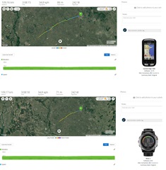
    in this route the total elevation is max ~100m, it is a pancake flat terrain, 2 years ago i went my old Edge 830 (and the older Edge 820 measured <100m before it, so every new series are calculation more and more on the same route..., i can recognize it easily due to i'm training on the same routes with same settings)  and Fenix 3 on almost the same route (just a bit shorter), check the elevation datas , the Fenix3 is the lowest , but that has "famous" strong filtering for flat terrain. The Edge 840 is completely wrong (the position of the Edges were on front mount, the watches are on handlebar mount, so same position on both rides...)

    I found my old Edge 1000 data too with F3, same route. So we can agree that this route has <100m total ascent, but the 358m by 840 is completely wrong....

  • wow, this looks indeed as the same problem.

    I'm wondering what Garmin says about this.

  • Garmin told me that it might be fixed in the next stable FW and that it maybe also already is fixed in the latest beta... Going to try that then...

  • Cool! i will able to test it in next march... Joy

  • yeah, I can probably test it earlier but still want some nice weather Wink.

    Though it might be an idea to send your ticket also in to raise more awareness.