Hi,
My Edge 840 shows its maps as being 2022.20.
How do I make sure this is the latest map available? 2022 seems old
Thanks
Hi,
My Edge 840 shows its maps as being 2022.20.
How do I make sure this is the latest map available? 2022 seems old
Thanks
Just as an FYI my NA maps are currently updating to 2023.10
If Garmin Express doesn't show a map update you have the latest maps.
it is not true, all my maps (17-06-2023 5.55am CET) are on 2022.10-11 (Garmin EU Cycle and ClimbPro, DEM, Geo) , only the TrailFork 2023.10 (which was updated 2-3 weeks ago or earlier). So probably the…
That much I knew, and that’s the reason I know I have 2022.20. But where officially we can see the latest available map version?
Just as an FYI my NA maps are currently updating to 2023.10
New maps were released today for NA (2023-06-14)
it is not true, all my maps (17-06-2023 5.55am CET) are on 2022.10-11 (Garmin EU Cycle and ClimbPro, DEM, Geo) , only the TrailFork 2023.10 (which was updated 2-3 weeks ago or earlier). So probably the maps are updated but not released to everyone immediately after the update. (or only NA maps are updated and the EU is still old)
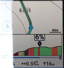
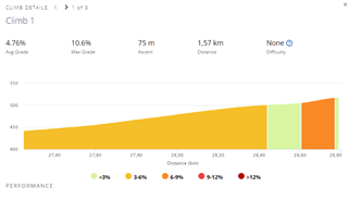
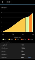
My other question about the ClimbPro maps: lots of elevation profile and end point (the climbpro is finishing /much/ sooner than the real top of the climb) are not accurate when the ClimbPro page is popping up, comparing with recorded elevation profile of the climb at the end of the ride in GC. So when i do once a climb (and others with same ClimbPro-capable units), will the Garmin refresh/update these obviosly wrong maps with the much more accurate elevation profiles coming from users units? I think the Garmin system is able to make it accurate very fast or replace immediately on the user's unit after 1 successful climbing is done and at the 2nd time i wanna see the accurate profile from my previous effort and not the original mess. Is it possible to implement?
(sorry for the reflection below, a wireless BT file transfer would be good/mandatory in Garmin units via GC app, i dont wanna connect my unit with cable everytime when i wanna download screenshots from the Edge unit, why cant it be coded , we are living in 2023 and not 2003)


All elevation data for the entire course when following a pre planned route is taken from the elevation data contained in the route file and is therefore completely down to the route planner used to create the course.
Only elevation data when not following a course is taken from the Garmin map data.
If you create a route from a recorded ride on your unit the elevation data will be as recorded during the ride.