This discussion has been locked.
You can no longer post new replies to this discussion. If you have a question you can start a new discussion

Different elevation in start and end point (loop route)

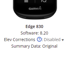
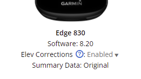
I've been experiencing this issue in many of my rides, if not all of them. In both Garmin Connect and Strava, the elevation of the start and end point of my loop routes is different (and always the same difference). I must say my Garmin FR 245 never fails at this. It's very annoying and I don't know why it happens... I'd really appreciate it if anyone know how to fix this. Thx!

Top Replies

All Replies

  • A one hectopascal change in atmospheric temperature is equal to approx 30feet. So, if you start and finish in same spot and it says you are 90ft lower at the end, then you have had a 3 hectopascal increase in air pressure eg.1010 to 1013. Likewise, if it thinks you are higher, then the air pressure probably dropped (maybe with a change in weather - hence low pressure system).
    I believe (it has been a while since I checked this) below 400m (approx 1200ft) barometric pressure is a lot less stable, so your watch has a lot more work to do. I live near the ocean and my rides rarely are the same at start and finish.

  • The 245 doesn't have a barometric altimeter.  I believe GC automatically "corrects" the elevation profile based upon the GPS locations of your activity for devices that don't have an altimeter.  The 830 has a barometric altimeter and GC will use the elevation profile measured by the 830.  You can force GC to "correct" the elevation profile by selecting "Enabled" in GC web for the given activity.  See screen shots below.

  • the elevation of the start and end point of my loop routes is different (and always the same difference).

    What is the difference?

    I must say my Garmin FR 245 never fails at this

    If the FR 245 is measuring the altitude/elevation each time, it wouldn't be perfect (there would be some variability).

    As  pointed out, the altitude/elevation reported for the FR 245 is being determined from an elevation database based on the coordinates. That's why it's always the same.

  • The 830 has a barometric altimeter and GC will use the elevation profile measured by the 830.  You can force GC to "correct" the elevation profile by selecting "Enabled" in GC web for the given activity.

    Note that Garmin considers the barometric data as better than the "correction".

  • The difference is always finishing the route at 20 m over the real elevation.

    Exactly, this is why I think, using a device like the 830, which features a barometric altimeter, I shouldn't use the elevation correction option in GC...