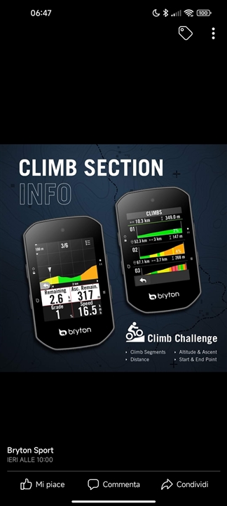
Dear Garmin, you invented the climb function by letting it die without ever improving it. Bryon created his own climb feature, which like wahoo's workout page is a thousand years ahead. When do you make a move?

Climb Pro is based of the elevation data in your course file. So will every other manufacturer's version such as this. If the source of your course file has bad elevation data then it will be off but that is nothing to do with your Edge unit. It is all down to the quality of the elevation data in your route planner.
If you create a course from a previous ride log then Climb Pro is better in my experience as the elevation data recorded by the Edge unit can well be better that what you get from route planner sites.
Then it would be nice if Garmin could add the elevation data to their maps. so they could use that for ClimbPro. Wahoo is doing that with their Bolt v2 (which I have) and it works fine with their on-device routing (they don't have anything like ClimbPro).
If Garmin did that the elevation data wouldn't really be any better than get from Strava/RwGPS/your other route planner of choice though. Everyone uses the same freely available elevation models of the whole planet and that has errors due to resolution issues/clouds/etc. No one is going to pay for high quality elevation data from national mapping agencies as it would be far too expensive.
I'm confused now on whether Garmin is using on-device (elevation) data or third-party elevation data from the track. What I saw was that the elevation data in Komoot was similar what the real world was doing, but the Garmin data was totally off (downhill sections in all-up climbs, 5% where it should have been 10% and vice versa).
I understand. I have my Komoot and Garmin accounts connected, so that all Komoot tracks are automatically available on the Edge. I have a feeling that Garmin is somehow modifying the files. Sometimes, the routes are not identical to what I planned in Komoot and the "virtual partner" is different (Komoot considers up and downhills, these detail is removed when the files goes through GC).
Garmin doesn't alter your course files. When you have your Garmin generate turn by turn directions it 'walks' along the route as described in your course file. It works out which roads/paths on its internal map line up with the course file. Sometimes this causes small deviations from what you planned in your route planner. If the map used in your route planner doesn't match the map on your Garmin very well you can get bigger deviations.
Regarding the virtual partner, some route planners put an average speed in which your Garmin will use for the virtual partner. Some don't put any info in so your Garmin will pick some pre programmed speed. This might be nothing like what your route planner uses. If you convert a previous ride into a course the virtual partner uses your speed as recorded on the source ride with all its variations.