This discussion has been locked.
You can no longer post new replies to this discussion. If you have a question you can start a new discussion

Straight line on bikepacking route. Impossible to follow navigation.

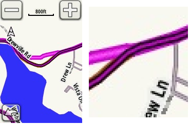
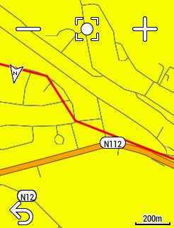
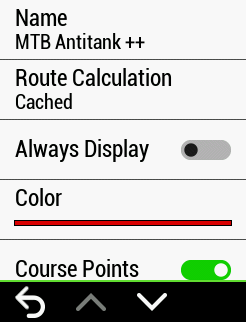
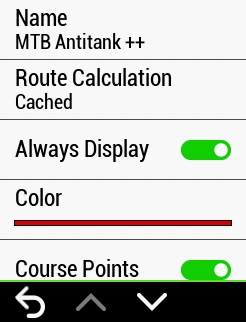
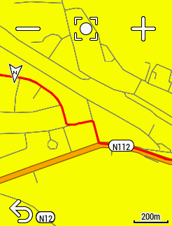
Last weekend i attempted a bikepacking event crossing some national parks and remote areas in my country (Spain), they gave us the entire route separated in several files by stage,my plan was not to stop the device after every stage, but load the routes as needed, as a keep on riding my activity untill i stop each day. At some point going solo, in the stage #2 the trail was not rideable but a small walking path. Around this point my Edge 830 draw a straight line, at first i was trying to follow this line and sadly ended up in the middle of nowhere, at this point i understood i was in trouble... Whenever i tried to load the route again i had the recalculate prompt in on screen. I was super frustrating and got me lost for quite some time, until i had the idea to use my phone and load the route in wikiloc to find my way (wikiloc does not use turn by turn navigation). After complete this problematic stage, i thought my problems were over, but i loaded the next route for stage #3, and inmediatelly found the same problem, taking me to a hill that leaded anywhere... The route was imported using Garmin BaseCamp, where it looks totally fine, i also imported it in komoot before the race, and in other apps, it looks good in all them...Also in the navigation preview in my 830, looks good. Other guys with garmin device had the same problem in the same area...I´d like to understand why this happened and try to prevent it in future. Also wonder if there´s any way to turn off turn by turn navigation in situations like this, and simply show my position and the line to follow in the map. 

Top Replies

All Replies

  • I don't use basecamp as I tend to load courses directly onto my edge so I don't know if that had any impact on the course file. It is possible that when you loaded to course & the garmin calculated the TBT it couldn't find a navigable route between the two points using the selected routing mode & avoidance settings in the activity profile, hence the straight line even though the course file contained the correct route.

    What routing mode were you using for the activity navigation? It is possible that selecting a walking routing mode might have had more success.

    Ultimately the edge is a cycle orientated device, which has cycle maps & not the topo maps like the Fenix etc so those maps may not have all routes that are not designated as cyclable

    Although it doesn't help for your event at the weekend, you may need to install a 3rd party OSM map on the edge, which has those features to use in future

  • if there´s any way to turn off turn by turn navigation

    Yes, under Navigation > Course Options you can disable "Turn Guidance" then when you load your course it is immediately available and if you have the map screen displayed you can just follow the Course line, If the course is complex then set the zoom to a level that you can see the course turns well enough. With all the various turn guidance issues I have long ago left Turn Guidance off and never get lost, and never have crashes even on on long long rides.

  • It is possible (though I haven't tried it) that even with turn guidance off it will still calculate your route adding the straight line.

    Another way is to select your route and set it to always display in the colour of your choice but don't press Ride.

    That way you could follow the course on the map but the downside is things like distance to go, eta, ete datafields won't work

  • The route was imported using Garmin BaseCamp, where it looks totally fine, i also imported it in komoot before the race,

    In BaseCamp, you plan trips as "routes". The Edges require tracks.

    If you created the trip in BaseCamp, depending on how you copied the file to the Edge, you might have gotten a route file.

    If you use "Send to Device" in BaseCamp, a GPX track file is created (which will be fine).

    • A track file contains enough points to accurately trace the turns and curves of your intended path.
    • A route file contains just the points you "must pass through". These files show up as straight lines.

    You can use the "Create track" button in the route property page in BaseCamp to get a track.

    Around this point my Edge 830 draw a straight line, at first i was trying to follow this line and sadly ended up in the middle of nowhere, at this point i understood i was in trouble

    The file you loaded to the device shouldn't have this straight line. (If it does, then the problem is with your file.

    For "turn guidance" (the big white arrows), the track has to trace roads/paths that are on the map installed on the device.

    I suspect there were two "lines": one (lighter) straight one (the "turn guidance" route) and a darker "curvy" one (the actual track).

    If you see two lines: the darker one is your track. When in doubt, follow that line.

  • I don't use basecamp as I tend to load courses directly onto my edge so I don't know if that had any impact on the course file. I

    BaseCamp works fine as long as the device gets a track (not a "route"). 

    It is possible (though I haven't tried it) that even with turn guidance off it will still calculate your route adding the straight line.

    No, it won't.

  • This is surely a software issue that I now also expierence for a while on my Edge 830. (after firmware update)
    Screenshots below, show the track ("Always Display" enabled) initially with straight lines.
    After disabling/enabling "Always Display" on this track, it will be shown corectly, nice folowing the road, no more straight lines.