This discussion has been locked.
You can no longer post new replies to this discussion. If you have a question you can start a new discussion

Navigation \ routing - Keeps on taking me down dirt tracks.

After my 1000 blew up i reluctantly forked out on the 830 as i've become heavily reliant on the round tip and get me home functions as i travel around the country a lot and don't have a clue where i'm going.

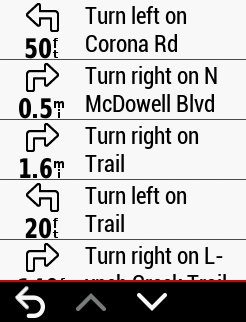
On the 1000 this function worked well but on the 830 i've been asked to ride across farmers fields and dirt tracks, surfaces my pride and joy road bike really aren't designed for. Its become that bad when i was in the Peak the other day that i turn my routing off and resorted to using google maps.

My activity setting is: Road and the Avoidance setting are set (The the green bar next to them) to avoid toll roads, unpaved road, ferries and narrow trails.

Is anyone else having similar issues or could recommend any settings i may have missing before it goes in the big (as Its not fit for purpose: navigation on a road bike).

Sorry for the rant, its a lot of money and its not fun being lost!

Thanks.

  • Hi. 

    I get around this problem by selecting Automobile in Routing Mode rather than road cycling. I’m not sure what implications this has over the metrics however it prevents me being taken down dirt tracks. 

    I would be interested in other thoughts on this too. 

    David

  • Cheers Dave, I noticed that setting last night, I just didn't fancy ending on the M6 but by the sounds of it, it's worth a shot.

    Last night's routing saw 3 bridleways and a footpath! (I was going to put it up for sale today and cut my losses).

    It's a definite step backwards from my 4yr old 1000... Well done Garmin. 

  • I recommend using Komoot to plan your routes and import them via IQ connect. On-device routing is broken AF.

  • Welcome to Garmin hell- I have complained to Garmin and they insist that their device works correctly as it should -it’s absurd it’s constantly taking me off course just to bring me back onto the same road; takes me down dirt trails when the device is set to avoid. I often need to use the address function to navigate and it’s a complete disaster most of the time so for the most part I rely on intuition and Google maps on my phone, which of course defeats the purpose of why i even got the device

  • Yeah.  They way I've used Edges is to lay out the course ahead of time on my computer, download it to the device, and then navigate it.  I've very rarely used or had success using the device to create a route that I would have chosen.  Laying it out on the computer, I have total control of the route and more resources to reference to decide if that's that route I want to take. 

    Another factor in having the Edge decide a course is the Edge only knows what's in the map data it has loaded.  If roads/paths/intersections are mischaracterized or the info is missing, the Edge can only go by what's there. 

  • You would think that since Garmin has been making car navigation for eons they could get this right and program it’s navigation software to create routes  in the most linear forward direction. If only they integrated Google maps’ Cycling data! I really wish Google would make their own device -they’d put Garmin out of business

  • I think cycling nav is more complicated than that for automobiles.  There are many more types of roads/paths/ways, associated intersections, characterizations of the surfaces, grades, etc.  In my experience, OSM map data has been better in this regard than Google's, particularly "off road"  for trails used in mtbing, many/most of which don't show up at all on Google maps.  I do think there is also quite a bit of variation between different regions/countries.  If you're interested in POIs, then Google is much better than OSM in my experience.

  • You would think that since Garmin has been making car navigation for eons they could get this right and program it’s navigation software to create routes  in the most linear forward direction. If only they integrated Google maps’ Cycling data! I really wish Google would make their own device -they’d put Garmin out of business

    It might be useful to have a specific example of the Garmin leading you onto a dirt path.

    As Looigi said, your issue could be incomplete map data (The Garmins use Openstreetmap data).

    Google likely has no interest in such a tiny market. They have enough trouble dealing with smartphones (a much, much bigger market). Most of what Google does uses data on their servers (which isn't really useful to you if you don't have cell network access).

    Google has a poor track record with devices and services. They often abandon projects.

  • I think cycling nav is more complicated than that for automobiles.  There are many more types of roads/paths/ways, associated intersections, characterizations of the surfaces, grades, etc.  In my experience, OSM map data has been better in this regard than Google's, particularly "off road"  for trails used in mtbing, many/most of which don't show up at all on Google maps.  I do think there is also quite a bit of variation between different regions/countries.  If you're interested in POIs, then Google is much better than OSM in my experience.

    Yes, it's much more complicated. Most drivers just want to get to a place the quickest way possible and have no issues using highways. Drivers are also less sensitive to a route being longer than it needs to be. It's also (relatively) cheap and easy to get the map data that drivers use.

    Cyclists have widely different opinions about what sort of road appropriate for riding. Drivers generally don't care (as long as it's paved).

    "Ways" (a generic term for roads and paths) tend not to change frequently. Points of interest (POI), for commercial entities, at least, change regularly and there are a lot of them. So, it's not surprising that Openstreetmap is better for ways and not for POIs. I'm a regular contributor to OSM and have no real interest in making sure commercial POIs are up-to-date (it would be too much work to do and compete with Google/etc).

  • Google map cycling navigation is a million times better and shows that it's not as complicated as Garmin makes it. Perhaps Garmin has too many competing data sets.  I don't understand the teck under the hood, I'll admit. But it were not not for battery life, I'd toss the garmin and use a small smart phone, period. 

    unnecessary trail diversion