Here's another one:
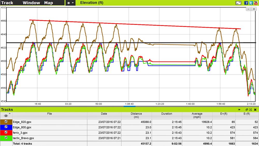
On my Edge 800 it is possible to have the Elevation Auto Calibrate to my starting location. I saved the location, and every time I start a ride from that location I get the pop-up that says the Elevation has Auto Calibrated to that location.
I can not find the same feature on my Edge 820. As a workaround, before starting a ride I go to Navigation>Adjust Elevation and set the elevation immediately before a ride. It is a bit cumbersome, and doeasn't seem to do as good a job as the 800 in managing Elevation over the course of the ride.
The 800 has a barometric Altimeter which means it does not take all the Elevation data from GPS. This has proven very reliable.
The specs for the 820 say it also has a barometric Altimeter, but the recorded Elevation data look like all the data points come from GPS.
Does the 820 indeed have a barometric Altimeter?
TIA for any help.