Edge 540 - elevation of imported course way too high

I just bought a brand new Edge 540 Solar and wanted to perform some tests before real life usage.
Software is updated yesterday to 26.16 + latest EU East maps from Garmin Express.

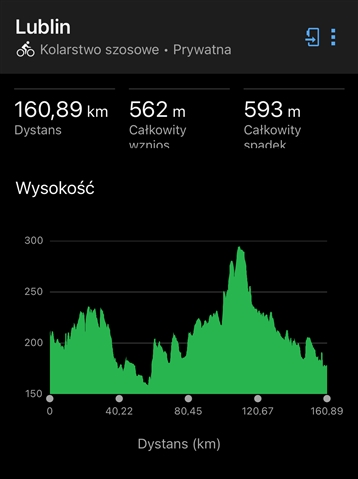
I have a long course, created last year. This course was created in Komoot, exported to GPX, imported to Garmin Connect. It shows the following elevation data:

On my old, trusty Fenix 6 Pro, elevation shows 481m, ok, let's say it's within tolerances.

Now, I sent the same, unmodified course to the new Edge and the results are way off:

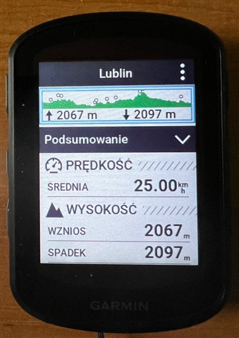
I rode this route last summer and I'm 100% certain, that the elevation was closer to 500m than to 2k. What is wrong?

  • I did more investigation and it turns out, that something is totally wrong with the saved course in my Connect account.
    I deleted the course from my Fenix and uploaded it again - now, the elevation changed from 481 to around 1700m.

    Then, I did something else: from GC web, I exported this route as a GPX and imported it again, without any changes, under different name. Now, the elevation is correct on both devices.

    I also tried to export it for 2nd time as GPX from komoot and import, still correct (although with differences - showing 700m when importing GPX->GC and 460m when exporting directly from komoot app).

    So, it must be some bug with this particular, saved course from previous year.