Hey,
I always have my Garmin on the screen where it shows my speed, distance, elevation etc. Then when I am nearing a corner it switches over to the map.
So far so good. But sometimes on sharp corners it's really messed up.
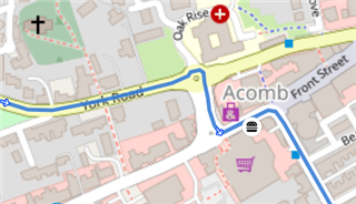
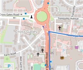
The blue line is the route i've created.
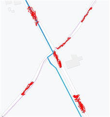
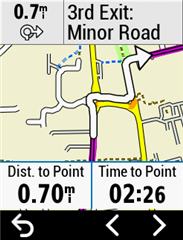
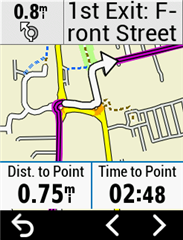
But when I'm nearing the corner I see something like this:
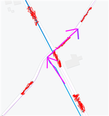
A zoomed in version of the corner, a IN 00:05 seconds in the right bottom corner. And the purple arrows shows how I need to go.
But then afterwards it's giving me "off course" message.
Is it possible that it's just switching over to the normal map and not being zoomed in?
I'll try to take a picture if it happens again..