This discussion has been locked.
You can no longer post new replies to this discussion. If you have a question you can start a new discussion

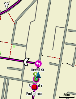
Navigation map

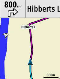
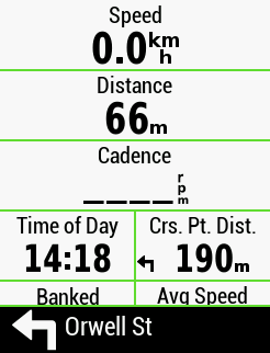
On the navigation map that pops up when you approach a turning, how do you alter the two data fields at the bottom, ie Direction and time to go before the turn, I have searched every where and cannot find the settings unless it is well hidden. Both of them I have no use for, ie, I do not need to know if I'm heading South or North etc or the time given is pointless, when the map pops up and says I turn in 30 seconds, I know I am going to turn in that time, but that time is changeable as I may slow down, but more importantly, I have no way of knowing how far down a road to look that could be 30 seconds away to look for a junction, especially in a town.

Preferably, I would rather see "Distance to Next" as then, I know to look about 100 yards down the road for my turning and plan my speed etc to make the turn and speed etc will not affect that distance unlike time can be.

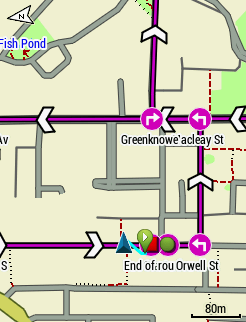
Also, can the distance that the navigation window pops up be changed, ie, mine pops up every time at 0.3 of a mile and stays on which is too far away, all it does is obscure the data fields I want especially when I am pacing a fast ride and is a nuisance as I then have to get rid of the navigation map by pressing the buttons and breaks the rythmn of the pace.

  • Yes, true but as the source OSM changes every day (don't know how often route planning sites change) and Garmin map yearly at best there is always differences possible

  • Yes, true but as the source OSM changes every day (don't know how often route planning sites change) and Garmin map yearly at best there is always differences possible

    The vast majority of what (roads/paths) you care about doesn't change very frequently in OSM. The "changes every day" stuff isn't really the issue at all.

    The route planning sites update their OSM data fairly frequently. Garmin provides updates every 6 months or so.

    =======================

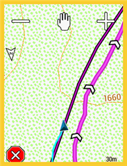
    This difference is significant. It seems the map on the device is a topo one and that the track was created using a recent OSM map. Given that the activity (recorded track) is following the loaded track, it seems the topo map is out-of-date (it doesn't accurately show the placement of the real road/path as it exists currently).

  • To insert "Course Points" into a course etc, I have found nothing better than "Garmin Training Centre" which I still use a lot today, its a discontinued product by Garmin many many years ago and never replaced with anything and I think you can still download it today.

    Basically all you do is load up the course, and where ever you want to insert a "Course Point" you just click on that point, a menu pops up and you just select what type you want, ie, turn, feed station, hill climb, summit etc and that is it apart from to upload to the Garmin.

  • It's easy to add custom course points in ridewithgps but you (now) need a subscription. You can also add them in Garmin Connect.

  • So thanks to these discussions (L Rouge and dpawlyk <- wat a difficult name to recall) i delved into how to get custom cues (course point) into the maps - one of the items on my Garmin bucket list - with RWGPS you'll need a subscription. But guess what came to the rescue - Garmin Connect !!

    In Garmin Connect - you can 'Add Course Point' when you're plotting a route - i did a bunch of them with customised messages along the route. Adding the course point is a bit of a fiddly thing - you'll need to point into a spot on the route and wait for the 1 finger pointer thing to shop then u can drop the Course point there. You can customise whatever message you like which is cool because i've always wanted to be able to add certain customised messages to alert myself on the route. Might be a good idea to place the course point about a good 10-30 m before the actual location due to GPS inaccuracies. Mine triggered a few metres after passing the location or thereabouts. 

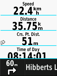
    Finally got to use Course Pt. Dist. !!! Never understood it until now - It displayed the distance to my next customised course point - how cool is that !! This has been a really productive discussion for me. Now i can place customised waypoint messages on the route. 

  • just one to put it out there that those custom waypoints like 'Feed Statn' are very very tiny on the map page - you'll need a magnifying glass to see it. It's just best to rely on the wordings at the bottom that pop up when you go over the waypoint. I noted that the Type symbol of the custom waypoint when it comes up is also very small.....tiny - like it's very discreet. So petite. Can't garmin enlarge that signage for better clarity.

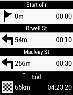
  • Yes, true and the great pity is that they used to be larger and more functional on the old 520 (not plus), attached some screen shots from the 520 showing the details in the Map Screen "Guide Text" and a larger bottom of screen notice which started to display about 80-100m from the point AND included a distance to point that counted down in real time, all brilliant and ultra useful, all from the TCX Course Points and involving no "navigation" processing. So useful that of course it was dropped from the 530 and all other devices !!! Very annoying yet another case of Garmin removing a great feature


    From an old relevant discussion forums.garmin.com/.../936048

  • Wow - that would be amazing if we have that feature in the 530 - very useful feature. Could easily be the killer reason for choosing a garmin over the Wahoo. Pity that Garmin doesn't give a shat about that.

  • Can't garmin enlarge that signage for better clarity.

    @Big Lamper you must have some influence with Garmin as one of the few improvements in the V8.63 Beta release is "Improved course point display and added new types"

    The difficult to see course point symbols previously black on white background are now an attractive and much more visible round symbol with pink background, the list of points has larger symbols and the bottom of screen notice also has larger symbols, haven't yet fully exercised the beta, the white "direction chevrons" become almost redundant and a bit too much now, I will ask beta team again for a switch to disable them


  • Over the past two days, I have been comparing "Garmin Connect" with "Garmin Training Center" to see which is the best for inserting Course Points.

    Hands down, "Garmin Training Center" wins for its simplicity and also by the fact that you have 100% compatability with the map as its the same OSM map installed into GTC that you also have on your Edge..

    In GTC, I can edit the saved course and insert CP's easily at road junctions etc for turns, select the icon and name them etc exactly the same way as I can in GC but far easier and despite being probably about 10 years old, has exactly the same few icons as GC.

    In GTC, I can just keep adding CP's when I am in the "Insert Course Point" menu which makes it speedy, unlike GC where you have to save one and then click again on "Add Course Point"

    IN GTC when it comes to inserting CP's at the bottom of the valleys and the tops of summits for hill climbs etc, I can use the elevation profile and mark the spot on that, on the map view, I also get a location mark of that point. Its then a simple case of inserting the CP on that point in the map view. You cannot do that in GTC, its guesswork where the tops of hills are.

    And when you finished in GTC adding them, you can see a list of all CP's entered and if they do not look right, rename them or change the name/title but only by 10 letters. GC only allows 15 letters. Also when you see the list, you can click on them in turn and the map will jump to that point. In GC, you have to trace the route and find where they are so you could easily miss one when you are doing a check.

    In fact, I do not see any turn CP's in GTC, unlike GC which has "Left, Right and Straight" but they must exist so I must be not seeing them as I see them in the screenshots above

    About the only advantage GC has, is being able to use satellite view to locate buiding's or precision points etc to mark up as a course point but, I always use Google Streetview to locate places if they are not marked up on the OSM map and find them that way, and it is very rare that they are not marked up with an icon on an OSM map so rarlely need to use a satellite view.

    Overall though I never use CP's for turns etc as I can see plain as day from the map that I have to turn and don't need an icon to tell me to turn. I only use Course points to mark checkpoints etc on long distance endurance events, but even then I dissect courses and routes to start and finish at a Checkpoint rather than load an entire course up so when the Course or route finishes, I know I am where I want to be. But for all this, I mainly use Garmin Mapsource which is also easier to add waypoints