This discussion has been locked.
You can no longer post new replies to this discussion. If you have a question you can start a new discussion

New Edge 530 public beta available 7.19

Download 

Notes:

  • For any issues that you encounter please fill out the form included in the download and attach it to an email to [email protected]. Please note that you may not get a response to the email unless we need more information on the issue you report.
  • Although this software is believed to be reliable, it has not yet been released for production and should be used at your own risk.

Changes made from version 7.10 to 7.19:

  • Course Routing
    Improved course routing speed.
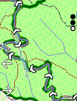
    Added automatic course route caching.
  • Map
    Improved map visibility and contrast with new map themes.
    Added a popularity layer to highlight roads that Garmin users have ridden the most.
    Added directional arrows to routes, courses, and history lines.
  • Phone
    Added smart syncing before an activity.
    Added a Sync Now button to the settings widget and the Connected Features > Phone menu.
  • Updated Firstbeat library for various improvements and bug fixes including a fix for training stats being reset on a multiple day activity.
  • CIQ
    Fixed issue with BLE sensors in CIQ data fields after waking the Edge from sleep mode.
    Fixed issue where activity controls would not work in a CIQ app.
    Fixed other minor issues.
  • Fixed several inReach issues.
  • Improved Garmin dual-mode sensor management.
  • Improved power meter calibration and software updates.
  • Improved the cycling dynamics page.
  • Increased maximum number of workout steps from 50 to 100.
  • Combined the indoor trainer Target Power and Resistance data fields into a single new 'Trainer Mode Value' data field that will dynamically change the title and value based on the current trainer mode between Target Power, Slope, and Resistance options.
  • Added support for including metabolic calories in the total calories reported in the calories data field and recorded in the activity file.
  • Fixed manual elevation calibration.
  • Fixed minor bugs.
  • Improved device stability.

Installation Instructions

  1. Connect your Edge 530 device to your computer using the micro-USB cable.
  2. Download and unzip Edge530_719Beta.zip folder.
  3. Copy the GUPDATE.GCD file from the Edge530_*** distribution folder to the \Garmin folder of your device's internal storage drive.
  4. If there is a GPS_*** folder, place the 006B310706.GCD file into the \Garmin\RemoteSW folder of the device. Please note, not all Beta releases will include an update.
  5. Disconnect your device from the computer, approve the update on the Edge, and wait for the update to finish.
  6. If you would like to revert to the last public release software, follow the above steps but place the GUPDATE_710.GCD file in the \Garmin folder. Rename the file to GUPDATE.GCD before disconnecting your device.
    NOTE: If you revert to an older version of software, all of your settings will be reset to defaults.
  • chevrons are quite sparsely distributed..

    I though way way too many, I would like option to turn them off completely, must try an out & back course to see if it doubles them going the other way. Get about the same number on 120m & 300m scale

  • Yes - always nice to have options - you can't please everyone.

    As for Virtual Partner - Garmin has never ever removed a feature no matter how useless it is - they are stubborn that way. 

  • is anybody there experiencing livetrack issues again with this beta?

  • No back arrows when the route is back and forth.

    You get only the relevant closest ones and only after passing that area, you'll get to see the back arrows.

  • Okay, had a chance to test it today again and syncing from the watch (Fenix 6) back to the Edge 530 seems to work. Let's hope for another sunny day tomorrow to test it the other way around too :-)

  • I like the chevrons the way they are!

    But I must have perfect eyes too, as I had no problems reading the screen at 6pm today - prefectly readable during cycling trough a darker forest section as well as trough a bright sunny area.

    Yet wahoo people also told us at first that no one needs colors, than that no one needs more than eight colors and now that everyone needs colors ;)

  • Ok, tested in the last 3 days on a cycling holiday, and here are my observations:

    1. I love the chevrons, super useful especially when multiple roads with similar color are on the screen - you clearly see which one is the one to take (the one with chevrons, obviously)

    2. No issues with the visibility at all

    Route caching... well, I love it when all goes well - the route loading is instantaneous! However I ran into couple of problems:

    * I was at home and loaded a route at my holiday location, just to try the functionality out. It appear to have loaded, then I shut down the 530. When I went to the holiday location, loaded the same route and it was instantaneous, but.... I had like 16 or so climbs. ClimbPro was spot on on the first one and then with each and every climb the starting moment (and respectively the finish moment) got moved by 50 meters or so. As I was getting to climb 12 and onward, I started seeing the ClimbPro almost at the end of the climb, which obviously was not super helpful. 

    * That made me think how can I now re-calculate the route to get it in order, but without a PC to delete the cached file I couldn't think of a way to do it. Perhaps option to "Force recalculate"?

    After that situation, for all my consecutive routes I had zero issues with ClimbPro - it was always spot on. Difference being I was around my starting point and loaded the route there for the first time (opposite to the above where I were like 200 km away when the calculation was done first).

    3. More than a few times I saw my HR sensor reconnecting, Phone the same, Speed sensor and AXS system as well. AXS I can imagine does go to sleep when not riding (coffee stop) but HR sensor I have no explanation. Funny enough I also have Quarq AXS - it never disconnected. All of the sensors are connected via ANT+ the only reason being that I believe that as "proprietary" protocol it should be more stable than BT? I could be wrong...

  • Agree 100% that we need an easy access to 'force' the unit to recalculate. There is a real need to recalculate since the unit is very stubborn to recalculate when needed, unlike the Nuvi car navigation units which are powered by the car's power and have the computation power to recalculate multiple times - the close you are to the destination, the more accurate the route. The 530 doesn't perform like that.

  • I also faced disconnection and reconnection of ANT+ units like my eMTB sensors.