where is this filter?
This is hidden to the user. It is implemented in the back ground and is applied to the pressure readings that in turn are used to compute elevation.
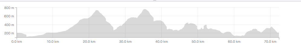
For interest's sake, here is elevation data with and without the filter. Note the softer edges on climbs and smaller climbs being smoothed out.
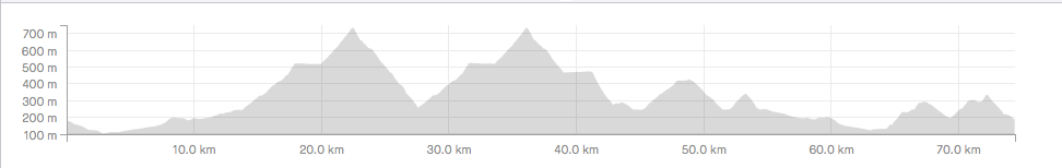
Map elevation data:
According to 530 with filter: