This discussion has been locked.
You can no longer post new replies to this discussion. If you have a question you can start a new discussion

Climbpro ? Am I missing anything

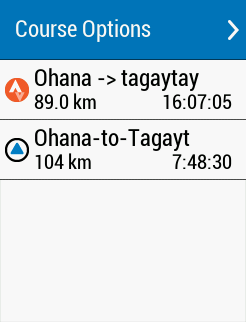
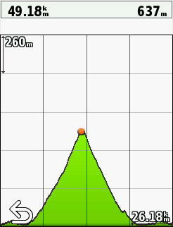
Did this activity chttps://connect.garmin.com/modern/activity/3844111612  and created the route beforehand. However, climbpro doesn't recognize any climbs. Am I missing anything ?

Note : Trying to upload the tcx file of the route I used but i got an error message when doing so.

Update: tcx file of the route :  https://wetransfer.com/downloads/ea4dc6458d5955b9274266622957f70020190716003846/2cab6b8f568ca7b33b664e31df4f038020190716003846/03ee6d

  • It should not be necessary to do that. Once the course is saved on the Edge then just loading it to ride it should work.

  • just tried to reset unit and data but nothing happened. Two files one uploaded with strava the other one created on ridewithgps. Only Strava one shows climbs


  • Could you post the one that is not showing any climbs. It could be that the elevation data is missing or it does not meet the ClimbPro requirements.

    Have a read of the document I posted that explains the ClimbPro requirements

    https://forums.garmin.com/sports-fitness/cycling/f/edge-530/168009/understanding-climbpro-on-the-edge

  • Hi, Thanks a lot. Yes I read it. It shouldn't be it is the same course. 

    https://we.tl/t-mQU4DYQ53c 

  • I will load the course on my unit, but the data looks little odd.

    Does the ride really start 365 meters below sea level?

    distance 0 m altitude -365.8 m
    distance 4.85 m altitude -365.8 m
    distance 8.77 m altitude -365.6 m
    distance 13.23 m altitude -365.6 m
    distance 19.7 m altitude -365.6 m
    distance 27.33 m altitude -365.6 m
    distance 34.87 m altitude -365.6 m
    distance 39.72 m altitude -365.6 m
    distance 45.56 m altitude -365.4 m
    distance 51.01 m altitude -365.2 m
    distance 54.94 m altitude -365.2 m
    distance 60.44 m altitude -365 m
    distance 124.63 m altitude -365.8 m
    distance 142.99 m altitude -366 m
    distance 149.43 m altitude -366 m
    distance 155.4 m altitude -366 m
    distance 160.35 m altitude -366 m
    distance 162.57 m altitude -366 m
  • I think the 2 sites are using different sources for the elevation data. It appears that the elevation data from RWGPS does not pass the 3% minimum grade rule, while the data from Strava does.

    If you post the Strava file I can overlay the 2 profiles and we can see where they differ.

    I applied an offset of 365.8 meters to all elevation values so that you were starting at sea level.

    I took a section of the climb starting at 23.63 Km (elevation 93 meters) and ending at 49.18 Km and 637 meters.

    Elevation gain (Rise)= 637 - 93 =544 meters

    Run = 49.18 - 23.63 Km = 25.55 Km = 25550 meters

    Grade % = (Rise/Run) X 100 = (544/25550) X 100 = 2.1%.

    Climbpro is only as good as the elevation data it is given to work on.