Hi folks. The context here is mountain biking in remote parts of the UK (largely away from roads in long distance rides through mountainous area).
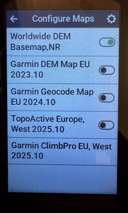
I was checking configs for my 1040 and found a map list. There is one map selected.
I don’t know what any of them are though. It’s a little different from another device I used to have where all the data for the UK was just ‘there’ and when you zoomed in you could see walkers paths in the mountains about appeared they had the equivalent of Ordnance Survey data (OS mapping)
DOna anyone happen to know what these unchecked maps are that I have installed. I do understand that some maps were removed recently and something called topiactive was added and read that that isn’t that relevant in the UK but don’t know if that’s true or not. I am also googling stuff too, but thought there may be people more clued up in what Garmin do with maps than I