This discussion has been locked.
You can no longer post new replies to this discussion. If you have a question you can start a new discussion

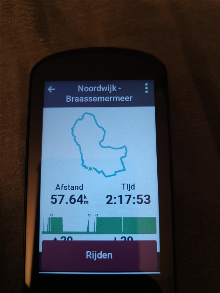
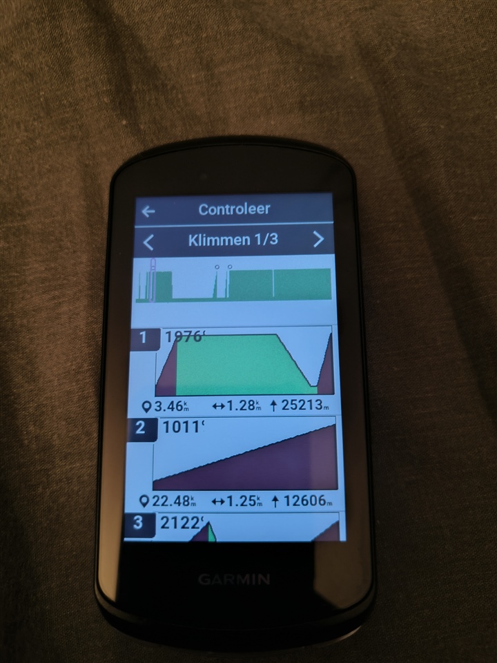
Preview course weird elevation graph and detecting non-climbs

Since a couple of months after an update my device is detecting climbs which is not even a bump on the road. Currently on 27.12

It's always the same segment i ride it detects and climb pro will say "climb".

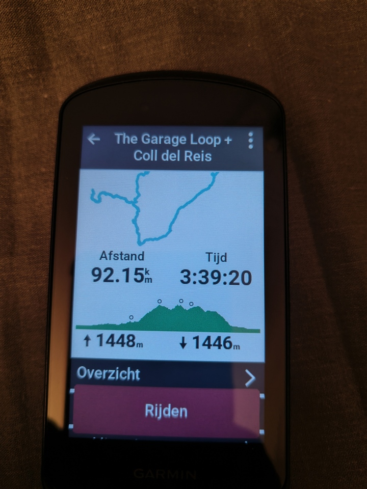
Attaches i have loaded 2 route. The garage loop is where there actually are climbs on the route and the other is just a flat route. As you can see the elevation graph and the climbs on the course is all weird.

Has anyone has this issue and was able to solve it?
  • Same problem, all the route the I try to make via strava in NL have crazy elevation change like yours (8000 meter mountain in the middle of flatlands) if I try to make a route in italy in the mountain no problem

  • Could I hazard a guess that the Noordwijk - route goes below sea-level 0m at points in NL and someone’s algorithm for calculating climbs is using positive integers, hence the -1 becoming a large positive number and implying climbing?

  • That would be a very good option, but i've used the device for almost 4 months already before it started "acting up" (after an update also) on these segments. And the first segment i was no where near Noordwijk.

  • Where did you create the route and how did you sync it with your Edge? There have been multiple reports of routes that are synced directly from a 3rd party platform like Komoot to Connect have these weird elevation issues.

    What you could try is download the GPX file of the route you planned, import that manually into Garmin Connect web and then sync with your Edge. That seems to preserve the correct elevation profile.

  • Good shout! Although I've been using Komoot for a longer time. I will try that out later, thanks all for your input!

  • Perfect! I couldn't wait until later and had a try. Export gpx and import it in garmin connect. All problem solved! Thanks Jim!

    The funny thing though it that in Komoot the route shows as 70m and in Garmin Connect 103.

  • Great! Now hopefully Garmin and/or Komoot can get this issue fixed.

    As for the elevation difference, elevation data is not an exact science and there are multiple sources of this data. Komoot and Connect most likely use different sources, resulting in the difference you see.

  • Nah, i meant more like if i import from Komoot to Edge 1040, it shows the weird elevation right? I'd expected the elevation in Komoot to be like very high aswell. But there is not much difference 

  • Ah ok. Komoot has the correct elevation profile (within margins of error), but it seems somewhere during the sync between Komoot and Connect (via Connect APIs) the elevation gets messed up.

  • Not only with komoot, i made the route with Strava, and i sync it to conenct, on the 1040 I get crazy elevation (today 25423 meter) 

    If in connect i duplicate the route is ok but i loose the segment in that way

    I think is right and is a problem with negative value