This discussion has been locked.
You can no longer post new replies to this discussion. If you have a question you can start a new discussion

how to create new course preferably on a laptop, then send it to the Edge

I am wondering what is the best way to create a course from scratch and load it on the Edge 1040 Solar. I have used Garmin Basecamp but I can't find free road maps for my area (Florida). I can create a course on the Echo itself, but that is not the friendliest interface and it gets tedious with longer routes. Also - what determines when the Echo will advise you of an upcoming turn? In the past, in Basecamp, I could put in waypoints that the device would alert me to ahead of time (GPSMAP 64sx). I haven't figured out yet how the Echo decides on alerts.

I'd like to be able to build my bike routes on a laptop (Win 10), then send it to the Echo 1040 once it is finished. What methodology do people use?

I tried creating a simple route (course) on Google Maps, converting to gpx, placing the gpx file in the Echo's "new" folder, but once the course is on the Echo, the waypoints were not honored by the Echo in the correct order, and it sent me all over the place.

Any ideas? Or a pointer to a tutorial? I just want to create a simple course around the neighborhood for starters, and I prefer not having to buy more software, jumping through hoops, etc.

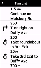
And I don't want alerts going every 100 feet or so. Just at major intersections, or what I decide are critical locations.

Also - separately - I did a simple ride out 6 miles and then stopped and selected "Reverse course" or whatever, to get back home. But the Echo kept insisting on telling me to make U turns, I guess to get to my endpoint. It never did guide me to the start. So I guess if I make a course, I'll have to also make a course to get home if I want to do an out and back. Is that really true??

  • Ok, so I always was under the impression that the navigation experience was different depending on whether you put a GPX Track, GPX Route or FIT Course file on the device, but after a quick test on my Edge 1040 it showed this is not the case and the different types of files result in the same functional experience. So thanks for pointing that out!

  • GPX Track, GPX Route or FIT Course file on the device

    The Edges (*) cannot use "GPX Route" files. "GPX Route" files (the ones that RWGPS produces) are waypoint files (not track files). 

    The Edges can read these files but they end-up being processed as straight lines connecting the waypoints, which isn't useful.)

    (Part of the confusion is that "route" is applied to different things.

    The way the Edges were used originally was to navigate with activity (recorded ride) files. Somebody figured out that one could fake these "activities".

    "Course points" were created so that units that did not have maps could provide turn instructions.

    What matters to the Edges is having track data.

    It doesn't matter what format the track data is in. The Edges convert GPX, TCX, and FIT to FIT "course" files (there isn't much "conversion" going on using FIT files as the source).

    ============================

    * Some Garmin GPS devices (not Edges) can use "route" (waypoint) files. It's vaguely possible that Garmin added this functionality to the 1040 but none of the earlier Edges can use these files. But I seriously doubt the 1040 can use waypoint files.

  • Ah I see. The GPX Route I tested was one created with Basecamp and calculated with activity Bicycling. This adds GPX extension elements to the GPX Route that contain the track data (in the schema it is called an "autoroute point"). This additional data apparently allows the Edge 1040 (and probably other Edges) to convert it to a FIT Course file.

    When a GPX Route file contains waypoints (wpt elements) these end up in the Navigation > Saved Locations list on the Edge 1040 by the way, just verified this on my unit.

  • When a GPX Route file contains waypoints (wpt elements) these end up in the Navigation > Saved Locations list on the Edge 1040 by the way, just verified this on my unit.

    There would have to be quite a lot of them to work well. That is, you should not expect that to work well. BaseCamp has a "Create Track" option. One should use that (and export the track item explicitly).

    Real tracks (activities) have points every second. When the synthetic tracks are created, they will have a lot less points for straight runs and more for curves and turns.

    (I could imagine that the "GPX route" file you created in BaseCamp came close to being a reasonably complete track file but it won't always.)

    (I knew about the wpt items going to locations. That's generally not very useful. The GPX Route files from RWGPS don't work the same way. You get wacky "tracks" from them.)

    What matters to the Edges is having track data (enough points to accurately trace the curves and turns of the path you want to follow).

    ---------------------------

    Note that, in the 1040 Boot Up you recently contributed to, someone imputed magic pixie dust to GPX files.

  • alternatives that allow you to create routes and have them wirelessly synced to your Edge

    Wireless syncing is useful but the downside with all of them is that the chain always includes Garmin Connect which strips out all Course Points in the original course both turn and custom. When you use Garmin Connect to plan the course it does not create course points for the turns because it assumes everyone will use on device turn guidance but only allows insertion of custom points.

    Wireless transfer of courses from RWGPS via CIQ apps like the one by  are an alternate which does not change the original course. PS apps.garmin.com/.../f03dbbbc-c4b8-4da8-af9c-f262af8c2d0e

    Why not just use Turn Guidance you ask? I find it unreliable , unfortunately especially on the 1040, it takes your course as only a suggestion and will route you differently if it finds some issue with your planned route, even if planned with OSM base map. I see many reports of crashes, reboots, restarts etc while “navigating” (with Turn Guidance) , never seen one blamed on using course points for course following. In addition to those I find Turn Guidance generates 2 or 3 times the number of notification alerts than the number of moderately curated course points needed. For example you get 2 notifications, (at about 200m & again 20m),  for every mini roundabout even if it is essentially a “just continue straight ahead”, in a course point based course I would delete anything that did not include an actual turn. It does my head in with constant beeping for no reason, hard to catch up with my sleeping while riding! Somewhere on the forum I have documented an average ride with almost 200 alerts for turn guidance in a 200km ride with something like 80 alerts being for these mini straight ahead roundabouts (40x2) and another 30 other unnecessary alerts.


  • I hope it is not too expensive. I have access to some level of RWGPS from my bike club but it I guess I can't edit/create with that access

    As I said in my first reply you can create/edit with a free account although some useful advanced editing functions and custom cues are only available to paid members. Also look into your club account access, for my club ALL users get premium course downloading access to the club repository courses (including the useful early notification of course points), and ride organisers  / leaders get premium creation / editing access (again only for club rides located in the club repository )

  • I haven’t had your issues with turn guidance on other units (800, 1030, 1030+).

    Being able to move the course points earlier make them more useful (since they would announce before the turn). That’s something RWGPS only provides with a paid subscription.

    I often get the course points to announce after the turn. So, they aren’t perfect either.

  • I haven’t had your issues with turn guidance on other units (800, 1030, 1030+)

    Prior to a year ago when I got my grown up 1040 I had for 10 years used cheaper usually non map devices (Edge 200, 510, 520, 530) so I have no experience with previous device turn guidance but it was/is a disappointment on the 1040 and quite a few users here say the same re comparison to navigation on previous devices. In my example “turn lists” above the 1st, 2nd, 3rd exits are all just straight ahead, about 12m away just across the road I am crossing. The Turn Guidance interface would be nice but I have never done a ride without some issue when using turn guidance so I just don’t use it now, frequently just follow the course line on the map although it’s nice having a few course points to break up a long route and have some intermediate goals via CRS PT DIST etc. The most recent 1040 release has further stuffed things up as it no longer gives off course warnings if turn guidance is off, even though off course warning is ON, I bet it never gets fixed.

    The moving the turn is available for RWGPS club account members, ie club pays but club members don’t have to have paid membership. As I have described before the 520 version 12.1 introduced notifications using course points in the guide text with countdown etc but it was never carried through to successor devices even though it was PERFECT.

    PS Of course part of my issue is that my club rides are mandatory routes with Garmin required detours not allowed

  • Roundabouts are more of an issue.

    More power to you if course points work for you!  I like the course point stuff too. But I think they can be confusing for new users.

    Yes, routes in a club RWGPS account work like you are paying (but your club is). Our club also has a RWGPS account.

    The 520 behavior sounds nice.

    Sounds like the 1040 software needs some work.

    I look at the map regularly too. Often, I know about turns before they get announced.

  • Even the way RWGPS describes roundabouts in course points isn’t all that useful. Their standard text is “At the roundabout take Exit 3 onto Beach Rd” and it gets truncated to something like “At the roundabout” when displayed.

    I quite often download the course TCX file and edit the text to something like “Exit 3 Beach Rd” and change the point type from Straight to Right or Left if it’s appropriate. (I know not everyone will want to do that).

    Distance to Next field is also handy as an early warning of the distance to go a turn and minimizes the need to look at the map.