Yesterday I took my new 1030 plus out for a first ride to try out navigation.
Didn't go very well, it basically beeped for me to take u-turns half the time for a reason hard to understand.
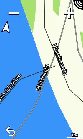
After trying to reproduce later it looks like it refuses to route me over a bridge with perfectly fine bike lanes.
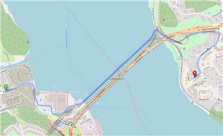
A simplified example is going from "Bobergsgatan" to "Solstigen" all in Stockholm, Sweden. It looks like this with both OSRM and GraphHopper routing on www.openstreetmap.org and is the route you would expect:
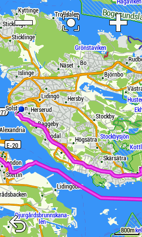
The Edge on the other hand want's me to take a huge detour + ferrry ( avoid ferry is even tunred on.) Looks like this:
Hard to understand since the Edge maps are based on OpenStreet map? Bug in routing? Has Garmin done a bad jo converting maps?
I was also looking forward to trying out the new "Pause navigation" feature. But never did I get a prompt for that nor can I find any reference to the feature in the documentation.
How is that supposed to work? Only for routes created off device?