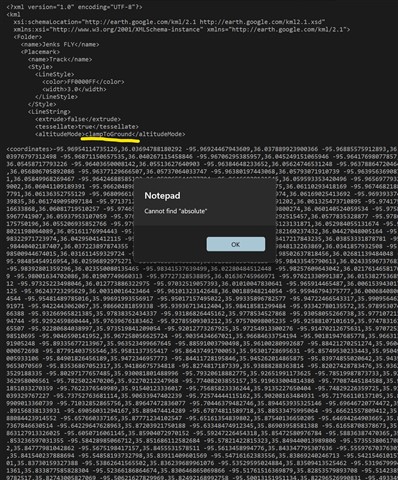
I have the Garmin D2 Pilot Watch and have that connected to Garmin Connect. When I do an "Export to KML" for Google Earth, the <altitudeMode> tag is set as <clampToGround>. Seems that since the D2 is collecting Altitude data, and that data shows accurately in Garmin Connect, that I should be able to "Export" the file and have the ability to include the <absolute> altitude in that export.
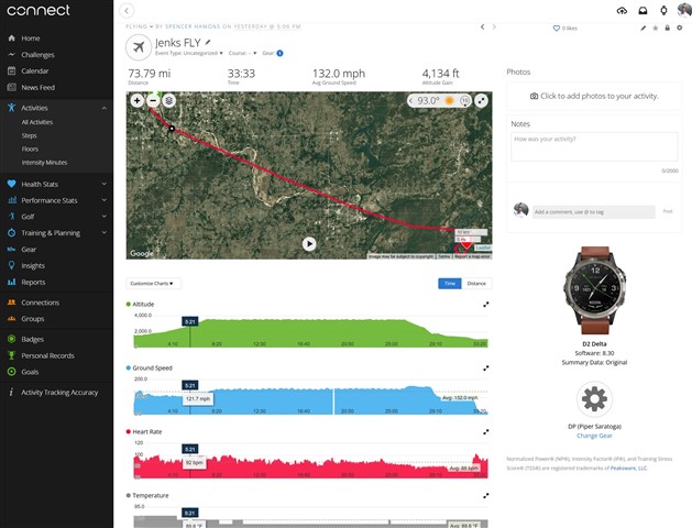
Attached are files from the GUI and the KML export file. KML export file shows all <altitudeMode> tags are set to <clampToGround>. GUI image shows that altitude was properly captured.
My intention for using this KML is to build a safety video illustrating the proper altitudes and flight paths for incoming pilots to use on their approach.
As a note, I am a beta tester for the Garmin Pilot program.
Spencer Hamons