To me the altimeter in the Instinct Solar is useless. Maybe I am using it wrong, maybe its a bug? Please advise.
I used to be unsatisfied with my Polar M430 (only GPS) showing a +-40m elevation difference on a +-30m run.
A pro. tri-athlete colleague at work told me that's actually pretty good. To get more accurate measurements I need a *barometric altimeter*.
Fast forward a few years and I buy a Garmin Instinct Solar.
I have not once gotten a reliable elevation measurement during a run.
To no avail I have tried calibrating before a run, during activities, watch mode barometer, watch mode auto, GPS + GLONASS, GPS + GALLILEO...
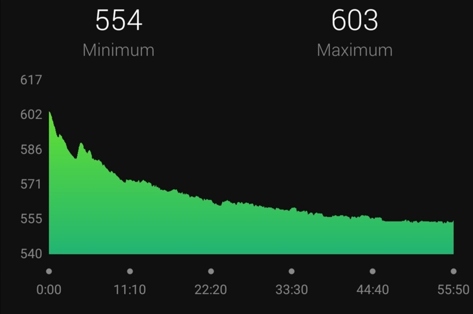
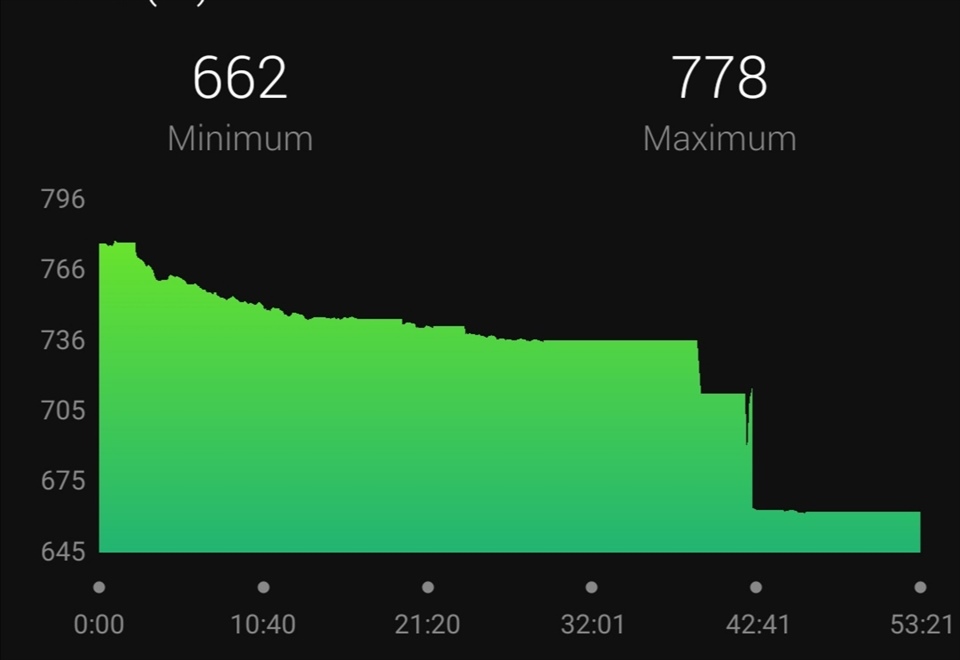
I run a loop, hence I expect ascent and descent to be the same, but they are wildly inconsistent. These are my last 4 runs (all along the same route):
| Date | orig. Ascent | orig. Descent | Adjusted in Garmin Connect | Height profile |
| 07.03 | +26 | -56 | +-53 | 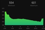 |
| 12.03 | +43 | -80 | +-44 | 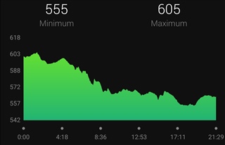 |
| 28.03 | +50 | -102 | +-50 | 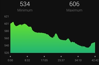 |
| 30.03 | +42 | -102 | +-42 | 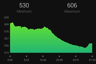 |
Also, is GPS not used for determining height at all? Even with "calibration during activity" I return far below where I started...
Almost every morning I rinse my watch with luke-warm water, focusing on the hole of the barometer.
Now I am running out of ideas. Is this normal? Help