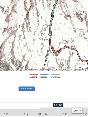
Occasionally, when recording activities with my Garmin Instinct 2S Solar, the final GPS tracks seem to "skip" portions of the activity. As a result, I end up with charts that look like the attached image, where there are sudden jumps in elevation gain. When exporting the GPX and importing to another software to check the validity of the tracks, the result is the same. There are sudden jumps in elevation or distance, as if the recording was paused. The recording is never paused or stopped. It's a real bummer when a significant portion of the elevation gain or distance is not tracked at the end of an activity. Can someone give me insight into why this might happen? I can't seem to find out a specific scenario that causes this to happen. This can happen to any activity, but I notice it the most for backcountry ski and hiking.
..