Altimeter calibration

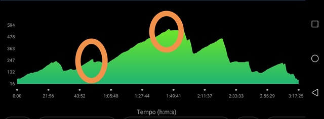
I calibrated altitude 2 times in this activity using gps.  Why does it need calibration when it would be enough to read the correct data provided by the gps?  Is it a bug?  Thank you

  • The accuracy of GPS elevation is quite limited. Under normal conditions, the barometer reading would be more accurate. Better than using the GPS elevation, in case the barometric elevation is incorrect, I'd recommend enabling the "Elevation Corrections" in Garmin Connect Web, which will then use the topographic data (DEM), which is usually more accurate than GPS alone.

    Some info here: GPS Elevation Reading Accuracy on Outdoor and Fitness Devices | Garmin Customer Support

    GPS elevation readings from your Garmin device are a good tool for approximating elevation when you are unsure of the actual current elevation.

    Accuracy of GPS Elevation
    Elevation calibrated by GPS is accurate to +/-400 feet with a strong GPS signal.

    Elevation is determined by the device acquiring a GPS signal, while maps will provide elevation information based on survey data. GPS elevation readings may be different than elevations on maps or marked on trails and roads.